I intend to log more items here than I have over the last several months. I’ll start with this summary of my backpacking season.
It started during a favorite month for hiking: May. During May’s first weekend, a couple of Mountaineers and I hiked up to the beginning of the big patches of snow in the Elwha River, in Olympic National Park (ONP) – all told, 16.5 miles one way. (We were more than a little tired at the end and not much less tired the next day.) We had good weather (which means no rain, even a little blue sky) and saw lots of wildlife, which is why May is such a good month. There were several bears, lots of deer, a few elk, a pair of Mergansers, several Harlequin ducks, an eagle, hummingbirds, a Hairy woodpecker, and lots of song birds.
I extended Memorial Day weekend to hike the 24 miles of the wild Olympic coast, starting at La Push and exiting at Cape Alava to Lake Ozette, accompanied by three Mountaineers. This stretch of the ONP coastal strip is easier than the southern portion in that there are few required bluff climbs, but harder in that the footing is quite difficult. There were almost no stretches of sand, but we walked on every variety of rock you can imagine – rough, smooth, hard and soft, big and small, settled and slipping, sticky and slippery. This is a wild and beautiful coast and a good place to see bald eagles (and the occasional bear on the beach).
A month later in June, three of us Mountaineers hiked up the ONP’s Hoh River trail in the hopes of seeing Mt Olympus’s Blue Glacier from Glacier Meadows. We had good weather and a beautiful hike, but the creek crossing in the second avalanche chute stopped us. It wasn’t that the chute was steep, it was more that the creek banks were too unstable to safely cross. So, we hung out in the sun and headed back down, ready to return for another go as soon as we could. Maybe next year.
The highlight of my season was the trip along the Pacific Crest Trail (PCT) from Harts Pass, in the far North Cascades, to Manning Park in British Columbia. This trip was organized by another Mountaineer leader, who couldn’t make the trip due to injury. He did, however, drive the four of us who weren’t injured to the trailhead. That’s generosity and that’s commitment. We had wonderful weather for all five days and the scenery was stupendous. This part of the PCT spends a good amount of time actually very near the crest itself, traversing ridgetops surrounded by the peaks of the North Cascades. Part way along, we fell in with a group of hikers who had been taking trips into the wilderness for the past 16 years, supported a string of good-sized donkeys. We also met a man near the end who had just completed the entire Crest Trail in several installments. The end of this trip, at Manning Park, offered an unusual opportunity to eat a meal in a restaurant, which we took advantage of twice, not to mention an afternoon beer on the day we arrived.
What should have been the highlight of the year (except for the weather) was my last backpacking trip: completing the last 33 miles of Mt Rainier National Park’s Wonderland Trail, from Longmire to Mowich Lake. I hiked the other 60-odd miles a few years back. My wife and I took the afternoon of Friday, Sept. 19, off to drive my car to Mowich Lake and then drive her car to Longmire, where we stayed in the National Park Inn. It’s a nice little inn with a good restaurant. That afternoon was pretty nice, with sun and some dramatic clouds showing off the Mountain. During the night, however, it started to rain and didn’t stop until early Sunday morning. I did enjoy the hike, but I never saw the Mountain again – I rarely saw the next ridge; nor was I dry until I changed at the end of the hike. Even without the views, I could see that it is a very dramatic stretch of trail, lots of ups and downs (10,000 feet over the distance), bridges over canyons and rushing rivers, or logs precariously perched over braided channels in broad debris beds.
I’m already thinking about the places I’ll go next year.
Showing posts with label hiking. Show all posts
Showing posts with label hiking. Show all posts
October 1, 2008


August 5, 2007
How do you say “Haute Route”?
Don’t know how to pronounce it, but in a month, I’ll be there, walking it. The route I’ll follow is the summer, hikers’ version of the famous ski mountaineering route between Mt. Blanc in France and the Matterhorn in Switzerland. I came across a description of the route years ago, in an Outside magazine article, and it’s been simmering in the back of my brain ever since. After missing a couple of earlier opportunities, I decided last year that this year was it.
The route begins in Chamonix, France and ends in Zermatt, Switzerland. It works its way into and out of valleys, over passes and alongside glaciers, skirting the northern side of the spine of the Alps between Italy and France-then-Switzerland, climbing up and down over the ribs bracing that backbone. The route is approximately 115 miles (187 km) long and amounts to over 37,000 feet (>11,000 m) of climbing, though none of it is technical. I plan to take two weeks, stopping each night in a town, village, or at a mountain hut.
I bought the recommended guide and read it through a couple of times. I loaned it out to friends I thought might be interested. I bought the maps recommended by the author and pored over them. (Beautiful maps, by the way.) I read every account of others who had made the trip that I could find. Along the way, I added the idea of taking in the start of the Oktoberfest in Munich, once the walking was over. And, as the year began, I started planning the trip.
This is quite a different kind of hiking than I’m used to, in some ways. The biggest difference is that most of my hiking and backpacking here in the Washington is in relative wilderness. If I’m to be out for several days, I won’t see anything approximating civilization for that whole time, unless I happen to catch a view of a distant town from some ridge top along the way. There is almost never a town or accommodation along the way. Nor is there ever anything like the public transportation that many of the towns along the Haute Route offer. These differences offer an increase in comfort and flexibility that, combined with the rich mountain history and the amazing scenery of the region, should make this a trip to remember.
Because of the relative availability of civilization, I won’t have to carry a tent, sleeping bag, stove, fuel, or cook set. At first, I thought that meant I’d be carrying essentially day gear, but with the travel to and from the end points of the walk and plans to spend a little extra time in Germany, I’ll have more. For instance, if I don’t want to wear my hiking boots every day of the three weeks I’m gone, I’ll need to carry another pair of shoes. Since I won’t be in the wilderness all of the time, I think I’ll need to observe higher standards of clothing cleanliness than a regular wilderness hike requires. That means more clothes.
And, since I intend to post dispatches to this blog along the way, as the availability of the requisite technology permits, I’ll be carrying a fair amount more in the way of electronics than I would bother with in the Cascades.
Over the next month, I’ll write about my preparations, starting with some advice I gleaned from another issue of Outside magazine, from Mark Jenkins, who was my favorite of their regular columnists, until they let him get away.
September 24, 2006
Lily Basin to Heart Lake
Yesterday, I accompanied the amazing Eric and seven other fellow Mountaineers to the Goat Rocks Wilderness on an excellent hike up the Lily Basin Trail and over Angry Mountain to Heart Lake. The weather was perfect with clear skies and warm air. And the company was excellent. Here’s a map and a slideshow.
The road to the trailhead climbs over 3000’ with one serious bump that requires either very careful driving or a high-clearance vehicle. The trailhead parking is just a pull-out on the road, though reportedly the stock trailhead, about a mile up the road, has a large lot.
The trail is very nicely graded and climbs gradually to the ridgetop along the south slope, with peeks at Mt. Adams. It then follows the ridgetop for a way, with none of the brutal ups and downs that ridgetop trails sometimes observe. As the ridge rises, the trail slips onto the north-facing slope, changing the views to the north, with Mt. Rainier and Packwood Lake as the stars. The temperature also dropped noticeably. Parts of the ground were still frozen, but the air was warming, even on this side. At about 3.5 miles, the view opens to the west, showing the snow-dusted slopes of Johnson Peak over the ridge ahead. Soon, the trail crosses the ridge to the south side again and begins the circuit of Lily Basin, the cirque at the head of Glacier Creek, under the cliffs of Johnson Peak.
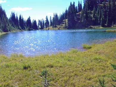
The end of the traverse brought us to the ridge of Angry Mountain and a junction with the Angry Mountain Trail 90, which traverses its namesake ridge eastward and drops down to a road at 2700’ in the valley of Johnson Creek. We headed the other way, dropping into the Middle fork of Johnson Creek and up to Heart Lake, which is nestled into the head of the valley on the south slopes of Johnson Peak. Heart Lake sits in a large meadowy basin, with lots of camping and wandering area. We spent an hour just lounging in the sun and enjoying the best kind of fall weather.
The road to the trailhead climbs over 3000’ with one serious bump that requires either very careful driving or a high-clearance vehicle. The trailhead parking is just a pull-out on the road, though reportedly the stock trailhead, about a mile up the road, has a large lot.
The trail is very nicely graded and climbs gradually to the ridgetop along the south slope, with peeks at Mt. Adams. It then follows the ridgetop for a way, with none of the brutal ups and downs that ridgetop trails sometimes observe. As the ridge rises, the trail slips onto the north-facing slope, changing the views to the north, with Mt. Rainier and Packwood Lake as the stars. The temperature also dropped noticeably. Parts of the ground were still frozen, but the air was warming, even on this side. At about 3.5 miles, the view opens to the west, showing the snow-dusted slopes of Johnson Peak over the ridge ahead. Soon, the trail crosses the ridge to the south side again and begins the circuit of Lily Basin, the cirque at the head of Glacier Creek, under the cliffs of Johnson Peak.

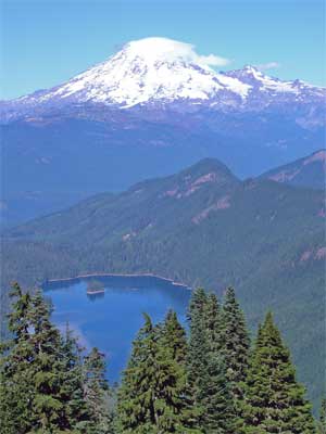

The end of the traverse brought us to the ridge of Angry Mountain and a junction with the Angry Mountain Trail 90, which traverses its namesake ridge eastward and drops down to a road at 2700’ in the valley of Johnson Creek. We headed the other way, dropping into the Middle fork of Johnson Creek and up to Heart Lake, which is nestled into the head of the valley on the south slopes of Johnson Peak. Heart Lake sits in a large meadowy basin, with lots of camping and wandering area. We spent an hour just lounging in the sun and enjoying the best kind of fall weather.
August 30, 2006
Buck Creek Pass
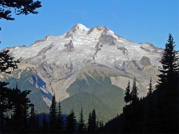
The weekend before last, I went on a hike with three other Mountaineers to Buck Creek Pass. It’s located in the central Cascades, just east of Glacier Peak, which looks like this: 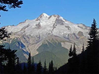
It was a great backpack, with a great group.
The first day was more driving than hiking, so we started in the heat of a hot day on the hot side of the mountains. That and the late start meant that we didn’t get to the pass the first day, but found a very nice little camping spot on a small tributary of Buck Creek. There’s a much bigger camp about ten minutes past our site. Besides the heat, the key first impression of this valley is that many of the trees are suffering from some sort of disease, which results in their branch tips are dead or dying. Higher in the valley, around 5000’, this seemed to abate.
The next day, with an earlier start, we made the pass a little after noon. The trail is very good, with a very steady grade. My old Holden quadrangle (data from 1944, minor corrections in 1968) has the trail following the creek all the way to the pass, but the real (probably new) location is much better, considering the steep terrain and serious slides. Buck Creek Pass is a broad sweep of mixed tree groves and meadow, ranging between 5600 and 5800’, settled between Helmet Butte and liberty Cap. It sits on the Cascade Crest, with volcanic Glacier Peak directly across the Suiattle River valley.
That afternoon, a trio of backpackers rested in our camp’s vicinity. Carl, Gretchen, and Andrew were about half-way through a three week section hike of the Pacific Crest Trail, having started at Stevens Pass, bound for the Canadian border. This was the last section of the Trail, the end of a fourteen year project to hike the entire way. They were looking forward to the laundry at Stehekin the next evening.
Flower Dome is an easy side trip from Buck Creek Pass. It lies just east of the pass and is wrapped with lush, flowering meadows. While walking through one to get a look back at the Pass, I flushed a grouse (which startled the heck out of me, as usual). The top is almost all open meadow and has great views. A few days later a hiker asked if you could camp on Flower Dome and I realized then that you could. There’s lots of room, as long as you carry your water over from Buck Creek Pass. On the way back, I surprised a marmot munching on the meadow plants.
The third day we spent hiking the good trail south, along the crest, almost to High Pass, which offers a route into the Napeequa River drainage. This is a great route. The trail switchbacks up the north side of Liberty Cap, before sliding around the west side, where it traverses through more beautiful meadows around the Cap to a pass to its south. Another meadowy traverse around the next bump on the ridge and then passing onto the east side of the ridge, along steep, rocky slopes, to a third pass. From there, we entered the rock and snow basin between our ridge and High Pass. There’s a beautiful, greenish-blue lake in that basin, which is the source of Triad Creek. One snowfield was a little too firm and a little too steep for the group to be able to get to High Pass, so we settled (if you could call it that) for expansive views to Glacier Peak, massive Clark Mtn., the Entiat range, and assorted other peaks in every direction you could look. On the return, there was fresh smoke arising behind Mt. Fernow, Seven Fingered Jack, and Mt. Maude, just one more fire to add to those still burning in the wilderness to the northeast.
Each afternoon in the pass, we witnessed a major landslide on Glacier Peak, filling Chocolate Creek with a cloud of dust, which then traveled down the valley into the larger Suiattle valley. We returned the next day, hiking out, stopping for dinner in Sultan, and worked the I-5 traffic to home, tired, but satisfied.
It was a great backpack, with a great group.
The first day was more driving than hiking, so we started in the heat of a hot day on the hot side of the mountains. That and the late start meant that we didn’t get to the pass the first day, but found a very nice little camping spot on a small tributary of Buck Creek. There’s a much bigger camp about ten minutes past our site. Besides the heat, the key first impression of this valley is that many of the trees are suffering from some sort of disease, which results in their branch tips are dead or dying. Higher in the valley, around 5000’, this seemed to abate.
The next day, with an earlier start, we made the pass a little after noon. The trail is very good, with a very steady grade. My old Holden quadrangle (data from 1944, minor corrections in 1968) has the trail following the creek all the way to the pass, but the real (probably new) location is much better, considering the steep terrain and serious slides. Buck Creek Pass is a broad sweep of mixed tree groves and meadow, ranging between 5600 and 5800’, settled between Helmet Butte and liberty Cap. It sits on the Cascade Crest, with volcanic Glacier Peak directly across the Suiattle River valley.
That afternoon, a trio of backpackers rested in our camp’s vicinity. Carl, Gretchen, and Andrew were about half-way through a three week section hike of the Pacific Crest Trail, having started at Stevens Pass, bound for the Canadian border. This was the last section of the Trail, the end of a fourteen year project to hike the entire way. They were looking forward to the laundry at Stehekin the next evening.
Flower Dome is an easy side trip from Buck Creek Pass. It lies just east of the pass and is wrapped with lush, flowering meadows. While walking through one to get a look back at the Pass, I flushed a grouse (which startled the heck out of me, as usual). The top is almost all open meadow and has great views. A few days later a hiker asked if you could camp on Flower Dome and I realized then that you could. There’s lots of room, as long as you carry your water over from Buck Creek Pass. On the way back, I surprised a marmot munching on the meadow plants.
The third day we spent hiking the good trail south, along the crest, almost to High Pass, which offers a route into the Napeequa River drainage. This is a great route. The trail switchbacks up the north side of Liberty Cap, before sliding around the west side, where it traverses through more beautiful meadows around the Cap to a pass to its south. Another meadowy traverse around the next bump on the ridge and then passing onto the east side of the ridge, along steep, rocky slopes, to a third pass. From there, we entered the rock and snow basin between our ridge and High Pass. There’s a beautiful, greenish-blue lake in that basin, which is the source of Triad Creek. One snowfield was a little too firm and a little too steep for the group to be able to get to High Pass, so we settled (if you could call it that) for expansive views to Glacier Peak, massive Clark Mtn., the Entiat range, and assorted other peaks in every direction you could look. On the return, there was fresh smoke arising behind Mt. Fernow, Seven Fingered Jack, and Mt. Maude, just one more fire to add to those still burning in the wilderness to the northeast.
Each afternoon in the pass, we witnessed a major landslide on Glacier Peak, filling Chocolate Creek with a cloud of dust, which then traveled down the valley into the larger Suiattle valley. We returned the next day, hiking out, stopping for dinner in Sultan, and worked the I-5 traffic to home, tired, but satisfied.
July 10, 2006
Olympic NP Coast, South Segment
I spent the weekend before the Fourth of July backpacking the south segment of the Olympic National Park coastal trail, from Oil City on the north bank of the mouth of the Hoh River to Third Beach at La Push, on the south bank of the Quillayute River. Three days of sunny afternoons, sand and tides, and a unique wilderness coast. There were just two of us, Karen and I, from the Olympia Mountaineers who made the trip, but we were the lucky ones.
We started at the trailhead at Oil City (no city, the map has an “oil seep” marked a few miles away) on a trail that follows the Hoh River down to the ocean, where it drops you on the beach and a huge pile of driftwood, trapped between the river and ocean. A few miles of beach walking, with one small headland which we rounded on rocks, brought us to the first of the dreaded headland trails. We were fortunate: the weather had been dry for at least a week, so the trails were as non-muddy as they ever get, which is a particular blessing when climbing up the steep headland access trails.
The first headland climb, up to the trail passing Hoh Head, was a nice introduction to the tricks of this route. It consists of three cable ladders – wood steps suspended on cables about fifteen inches apart hanging down the steep slopes. The first two ladders came one after the other and were in fair shape. The last one was nasty – steep, slippery, and missing critical rungs at the top. Still, we topped it and climbed up to the top and through some pretty woods. There were lots of downed trees on this stretch – we even lost the trail to one for a time – but soon we were past Hoh Head and walking along the top of the bank with wonderful views of the ocean, its rocks and reefs, and beautiful, blue skies and water.
The old trail down to the beach just north of Hoh Head (which requires a quite low tide to continue north from there) was lost to a massive slide and we saw no sign of it at all. It wasn’t in our plans, anyway, because the tides that weekend were only moderate (low of one foot, high of nine feet), but were well-timed for midday. Late in the afternoon, we came across the first of the camps and descended to Mosquito Creek, where we camped. There were a small party camped in the woods, a couple camped on the beach, and, later, a group of seven hikers joined us for the night.
Crossing Mosquito Creek is one of the obstacles on this route, but presented no problems with the tide conditions and low water flow that we had. A pelagic cormorant rookery was established on the rock face of the headland to the south of our camp, with the long-necked birds constantly wheeling onto and off of the face. For a while, a falcon harassed them, but we didn’t see any other result.
The couple camped on the beach near us turned out to be Seattle Mountaineers and had noticed this hike listing, no doubt wondering how many backpackers I was going to bring them to crowd out their enjoyment. We spent part of the evening talking with them around their fire and then settled into our tents for the night.
The next morning our path took us up the beach for a couple of miles, over a headland with crossings of Goodman and Falls Creeks, and down to a camp on the beach at Toleak Point. The first beach stretch was slow going, because of the wonderful tide pool life amongst the big rocks and sea stacks left behind by the retreating tide. The trail up the bank south of Goodman Creek was better than Hoh Head’s, though the trail on top was much brushier. The creek crossings were easy, though I did manage to get water in one of my boots.
The trail down to the beach south of Toleak Point was an excellent cable ladder down solid rock. It seemed quite secure compared to some of what we’d seen. Just before we descended, we passed a couple going the other way with their golden retriever, which they’d loaded into a pack, emptied for the purpose, and carried up the ladder. (Pets aren’t allowed on the trail, but, you know, the rules don’t actually apply if you pretend to not know them or not see the hundreds of posted notices.)
There were five or six groups camped on the beach along the south side of Toleak Point and more camped in the woods on the west-facing beach north of the point. We started in the woods, but the wind was blowing right into them and the sun around the point made it feel fifteen degrees warmer, so we camped on the beach in the sun, nearer the only water. The tide came in from both sides of the point, making an interesting set of currents and flows as the two sides converged. Seals played in the water and eagles soared in the skies.
We were concerned about the group of just-short-of-middle-aged men who had sprawled their camp right on the only water source and in front of the trail to the privy. When we arrived they were drinking the biggest beers I’ve ever seen open and playing baseball on the beach. They followed this up with an enormous bonfire on the beach. Still, we were upwind and they ran out of gas early in the evening and were still getting up when we hiked out, so they weren’t a problem.
The final day offered a nice hike up the beach to Strawberry Point, where we saw more eagles and tide life, along another beach to another point which could be rounded on the rocks above the beach, to the camp at Scott Creek and the headland called Scotts Bluff. There was a large group camped there, right on the creek, as well. The trail on the south side of the Bluff was quite good – it climbed in a very civilized manner to the top, through some pretty woods – spruce and hemlock – to a very abrupt, steep clay slope, with ropes for assistance. I’m glad it was dry, for the footing was good. Wet would have been another experience.
The next leg was a short beach walk to the Taylor Point headland. The trail here was showing signs of nearing civilization. After a short scramble up a clay bank, it was solid stairs up the slope! This trail dropped back down to the beach over a couple of cable ladders in very good repair. And, then we were on Third Beach, which is well within reach of almost anyone, and it showed. There were lots of people on the beach, quite in contrast to our experience just over the last headland, and no wonder. It’s a beautiful beach, the weather was wonderful, and the parking lot is less than a mile and a half away.
We made short work of that last stretch, accompanied by the couple from Seattle, to whom we gave a ride into Forks. I’d had my car moved from Oil City by Rainforest Paddlers, who offer a shuttle service. To my delight, my car was there. To my credit, I had a set of keys in my pack, because I couldn’t find the keys that shuttlers had used to drive the car around. To the discredit of Rainforest Paddlers, when I called them to find out where my keys were, I learned that, instead of putting them in the trunk (I had a set in my pack, remember), under the mat, as I’d asked and as had been communicated to the shuttler, she decided to put them in the “usual” place, under the bumper. So, by the time I’d learned this, they had long since shaken loose. She called it a communications break-down, in spite of admitting that she’d received the communication fully. She just decided that she knew better. I call that an error in judgment. Fortunately for future trips to the coast, there is an alternative: Windsox Trailhead Shuttle.
Even that was nothing more than a minor irritation, given three days of sunny afternoons, dry weather, favorable tides, beautiful scenery, good company, interesting geography, topography, and wildlife.
We started at the trailhead at Oil City (no city, the map has an “oil seep” marked a few miles away) on a trail that follows the Hoh River down to the ocean, where it drops you on the beach and a huge pile of driftwood, trapped between the river and ocean. A few miles of beach walking, with one small headland which we rounded on rocks, brought us to the first of the dreaded headland trails. We were fortunate: the weather had been dry for at least a week, so the trails were as non-muddy as they ever get, which is a particular blessing when climbing up the steep headland access trails.
The first headland climb, up to the trail passing Hoh Head, was a nice introduction to the tricks of this route. It consists of three cable ladders – wood steps suspended on cables about fifteen inches apart hanging down the steep slopes. The first two ladders came one after the other and were in fair shape. The last one was nasty – steep, slippery, and missing critical rungs at the top. Still, we topped it and climbed up to the top and through some pretty woods. There were lots of downed trees on this stretch – we even lost the trail to one for a time – but soon we were past Hoh Head and walking along the top of the bank with wonderful views of the ocean, its rocks and reefs, and beautiful, blue skies and water.
The old trail down to the beach just north of Hoh Head (which requires a quite low tide to continue north from there) was lost to a massive slide and we saw no sign of it at all. It wasn’t in our plans, anyway, because the tides that weekend were only moderate (low of one foot, high of nine feet), but were well-timed for midday. Late in the afternoon, we came across the first of the camps and descended to Mosquito Creek, where we camped. There were a small party camped in the woods, a couple camped on the beach, and, later, a group of seven hikers joined us for the night.
Crossing Mosquito Creek is one of the obstacles on this route, but presented no problems with the tide conditions and low water flow that we had. A pelagic cormorant rookery was established on the rock face of the headland to the south of our camp, with the long-necked birds constantly wheeling onto and off of the face. For a while, a falcon harassed them, but we didn’t see any other result.
The couple camped on the beach near us turned out to be Seattle Mountaineers and had noticed this hike listing, no doubt wondering how many backpackers I was going to bring them to crowd out their enjoyment. We spent part of the evening talking with them around their fire and then settled into our tents for the night.
The next morning our path took us up the beach for a couple of miles, over a headland with crossings of Goodman and Falls Creeks, and down to a camp on the beach at Toleak Point. The first beach stretch was slow going, because of the wonderful tide pool life amongst the big rocks and sea stacks left behind by the retreating tide. The trail up the bank south of Goodman Creek was better than Hoh Head’s, though the trail on top was much brushier. The creek crossings were easy, though I did manage to get water in one of my boots.
The trail down to the beach south of Toleak Point was an excellent cable ladder down solid rock. It seemed quite secure compared to some of what we’d seen. Just before we descended, we passed a couple going the other way with their golden retriever, which they’d loaded into a pack, emptied for the purpose, and carried up the ladder. (Pets aren’t allowed on the trail, but, you know, the rules don’t actually apply if you pretend to not know them or not see the hundreds of posted notices.)
There were five or six groups camped on the beach along the south side of Toleak Point and more camped in the woods on the west-facing beach north of the point. We started in the woods, but the wind was blowing right into them and the sun around the point made it feel fifteen degrees warmer, so we camped on the beach in the sun, nearer the only water. The tide came in from both sides of the point, making an interesting set of currents and flows as the two sides converged. Seals played in the water and eagles soared in the skies.
We were concerned about the group of just-short-of-middle-aged men who had sprawled their camp right on the only water source and in front of the trail to the privy. When we arrived they were drinking the biggest beers I’ve ever seen open and playing baseball on the beach. They followed this up with an enormous bonfire on the beach. Still, we were upwind and they ran out of gas early in the evening and were still getting up when we hiked out, so they weren’t a problem.
The final day offered a nice hike up the beach to Strawberry Point, where we saw more eagles and tide life, along another beach to another point which could be rounded on the rocks above the beach, to the camp at Scott Creek and the headland called Scotts Bluff. There was a large group camped there, right on the creek, as well. The trail on the south side of the Bluff was quite good – it climbed in a very civilized manner to the top, through some pretty woods – spruce and hemlock – to a very abrupt, steep clay slope, with ropes for assistance. I’m glad it was dry, for the footing was good. Wet would have been another experience.
The next leg was a short beach walk to the Taylor Point headland. The trail here was showing signs of nearing civilization. After a short scramble up a clay bank, it was solid stairs up the slope! This trail dropped back down to the beach over a couple of cable ladders in very good repair. And, then we were on Third Beach, which is well within reach of almost anyone, and it showed. There were lots of people on the beach, quite in contrast to our experience just over the last headland, and no wonder. It’s a beautiful beach, the weather was wonderful, and the parking lot is less than a mile and a half away.
We made short work of that last stretch, accompanied by the couple from Seattle, to whom we gave a ride into Forks. I’d had my car moved from Oil City by Rainforest Paddlers, who offer a shuttle service. To my delight, my car was there. To my credit, I had a set of keys in my pack, because I couldn’t find the keys that shuttlers had used to drive the car around. To the discredit of Rainforest Paddlers, when I called them to find out where my keys were, I learned that, instead of putting them in the trunk (I had a set in my pack, remember), under the mat, as I’d asked and as had been communicated to the shuttler, she decided to put them in the “usual” place, under the bumper. So, by the time I’d learned this, they had long since shaken loose. She called it a communications break-down, in spite of admitting that she’d received the communication fully. She just decided that she knew better. I call that an error in judgment. Fortunately for future trips to the coast, there is an alternative: Windsox Trailhead Shuttle.
Even that was nothing more than a minor irritation, given three days of sunny afternoons, dry weather, favorable tides, beautiful scenery, good company, interesting geography, topography, and wildlife.
June 18, 2006
Mt. Townsend
Saturday, I took a small group of Mountaineers up the trail to the top of Mt. Townsend, west of Quilcene. My streak of view-seeking peak-hikes arriving to clouds and no-views remains unbroken. On the drive up Hood Canal, we were treated to one of the great views in this part of the country: morning sun along a placid Hood Canal. As we continued north, to just short of Quilcene, and left the highway for the forest road that leads to the trailhead, the clouds built over the mountains.
We parked at the lower trailhead and started up a narrow, but well-built trail. While it wasn’t raining, the brush was wet enough to make us consider more raingear. The upper parking lot had a few cars and starts a wider trail, which enters the Buckhorn Wilderness and starts a nice stretch of classic, Western hemlock-Red cedar-Douglas fir forest. Then, the climb begins. From bottom to top, it’s 5 miles and 3400 vertical feet to the top. The trail is excellent, climbing through woods and then breaking out onto a broad, open mixed meadow, which suggests good views. There were a number of flowers blooming: rhododendrons, strawberries, glacier lily, and lots of others that we couldn’t identify (having left the book in the car, where it was safe, but less useful). We had no views, as by that time it was raining lightly. By the time we reached the ridge top, the wind was up and the rain was steady. We only stayed warm, in spite of being well-equipped, because we were walking up hill.
The summit was kind of spooky in the fog, with chunks of volcanic rock sticking up out of mossy heath. I understand it supports spectacular views of the Straits of Juan De Fuca, Puget Sound, the Cascades, and an array of Olympic peaks. We were unable to appreciate them, however, as our short time on the top was filled with adding layers and quickly eating something. By this time, it was sleeting. It would have been lonely, but a couple of chipmunks worked us for a snack.
The trip down was much quicker than that up and we gradually warmed up. Along the way, we saw about twenty other people on the trail, in spite of what was a far from perfect weather day. As we dropped back down to Quilcene, the clouds parted and the sun came out. That’s what happens in the mountains.
We parked at the lower trailhead and started up a narrow, but well-built trail. While it wasn’t raining, the brush was wet enough to make us consider more raingear. The upper parking lot had a few cars and starts a wider trail, which enters the Buckhorn Wilderness and starts a nice stretch of classic, Western hemlock-Red cedar-Douglas fir forest. Then, the climb begins. From bottom to top, it’s 5 miles and 3400 vertical feet to the top. The trail is excellent, climbing through woods and then breaking out onto a broad, open mixed meadow, which suggests good views. There were a number of flowers blooming: rhododendrons, strawberries, glacier lily, and lots of others that we couldn’t identify (having left the book in the car, where it was safe, but less useful). We had no views, as by that time it was raining lightly. By the time we reached the ridge top, the wind was up and the rain was steady. We only stayed warm, in spite of being well-equipped, because we were walking up hill.
The summit was kind of spooky in the fog, with chunks of volcanic rock sticking up out of mossy heath. I understand it supports spectacular views of the Straits of Juan De Fuca, Puget Sound, the Cascades, and an array of Olympic peaks. We were unable to appreciate them, however, as our short time on the top was filled with adding layers and quickly eating something. By this time, it was sleeting. It would have been lonely, but a couple of chipmunks worked us for a snack.
The trip down was much quicker than that up and we gradually warmed up. Along the way, we saw about twenty other people on the trail, in spite of what was a far from perfect weather day. As we dropped back down to Quilcene, the clouds parted and the sun came out. That’s what happens in the mountains.
June 11, 2006
The Hidden Rainforest
Over the Memorial Day weekend, I led a nice group of Mountaineers up the Bogachiel River for a three day backpack trip. This river flows west out of the north side of the Olympic Mountains. It joins up with the Calawah River just west of the town of Forks and then with the Sol Duc River to form the Quillayute River, which flows into the Pacific a few miles later. It is the least well-known of the rain forest rivers on the peninsula and it is a gem.
The trail follows the river valley for over twenty miles to a pass high in the Olympics. We followed it for fifteen miles of its length. At first, it is a turnpike, wandering through river flats so green you can’t imagine anything any greener. Once you’re into the National Park, you start seeing some big trees, spruces mostly here. The first six miles take you to an interesting trail over Indian Pass to the Calawah River and extensive camping. And lots of big trees – Sitka spruce, red cedar, Douglas fir, cottonwood, and western hemlock – some of them six feet or more in diameter. There are fewer big, mossy maples in this valley than the Hoh valley, so this looks like a more conventional forest, but big. There are a few photos from the trip here.
After the first few miles, the trail starts living up to the description we heard in the Information Center in Forks: rough. This was late May, so there were many creek crossings, few bridges, and quite a bit of muddy trail. There were also many, many trees and limbs down on and across the trail. It wasn’t raining, but it was still damp and the creeks were running, so none of us completed the ten miles to Flapjack Camp with dry feet.
The next day, under damper skies, we followed the trail further, as it roughened into a very narrow track, which occasionally disappeared under small herbs and moss. Four miles from our camp, we reached a shelter and the very fine bridge over the North Fork of the Bogachiel. During this day trip, the river changed from a broad, dynamic flow, sluicing back and forth across a huge gravel bed, to a rushing river, confined to a narrow valley – a canyon in places – and running on a solid rock bed.
On the trail, above Flapjack camp, we spooked a group of a half-dozen of elk. Sometimes, they silently disappear in the woods, but this time they just crashed away. We also saw four (or maybe the same pair, twice) eagles cruising the river. On the way back out, I saw a pileated woodpecker and several dippers. The river terrain around our camp had a lot of evidence of past beaver habitation, but nothing was new. Also near our camp, I saw fresh bear tracks in some clay along the river and coyote tracks in the sand.
This is a wild place.
The trail follows the river valley for over twenty miles to a pass high in the Olympics. We followed it for fifteen miles of its length. At first, it is a turnpike, wandering through river flats so green you can’t imagine anything any greener. Once you’re into the National Park, you start seeing some big trees, spruces mostly here. The first six miles take you to an interesting trail over Indian Pass to the Calawah River and extensive camping. And lots of big trees – Sitka spruce, red cedar, Douglas fir, cottonwood, and western hemlock – some of them six feet or more in diameter. There are fewer big, mossy maples in this valley than the Hoh valley, so this looks like a more conventional forest, but big. There are a few photos from the trip here.
After the first few miles, the trail starts living up to the description we heard in the Information Center in Forks: rough. This was late May, so there were many creek crossings, few bridges, and quite a bit of muddy trail. There were also many, many trees and limbs down on and across the trail. It wasn’t raining, but it was still damp and the creeks were running, so none of us completed the ten miles to Flapjack Camp with dry feet.
The next day, under damper skies, we followed the trail further, as it roughened into a very narrow track, which occasionally disappeared under small herbs and moss. Four miles from our camp, we reached a shelter and the very fine bridge over the North Fork of the Bogachiel. During this day trip, the river changed from a broad, dynamic flow, sluicing back and forth across a huge gravel bed, to a rushing river, confined to a narrow valley – a canyon in places – and running on a solid rock bed.
On the trail, above Flapjack camp, we spooked a group of a half-dozen of elk. Sometimes, they silently disappear in the woods, but this time they just crashed away. We also saw four (or maybe the same pair, twice) eagles cruising the river. On the way back out, I saw a pileated woodpecker and several dippers. The river terrain around our camp had a lot of evidence of past beaver habitation, but nothing was new. Also near our camp, I saw fresh bear tracks in some clay along the river and coyote tracks in the sand.
This is a wild place.
May 20, 2006
Mt Zion
I went hiking this morning with a group of Mountaineers hike leaders, organized by Eric as a way to get to know each other better and share ideas about leading hikes. Considered against that criterion, I’d call it a success. As a hike, it was also good, but there were no views at the top.
The hike is in the Olympic National Forest, in the northeast corner, east of Quilcene, about 85 road miles from the Forest headquarters in Olympia. It’s a short hike of about 1.8 miles and 1300’ gain to the top of a small peak with views all around. Mt. Zion hosted a fire lookout until 1975. I could only believe our leader when he said that there are views of the northern Cascades, Mt. Baker, the Straits, and Vancouver Island from the top. Today, there was nothing but clouds. Still, the air was still and it wasn’t cold, so we lingered on top for over an hour.
The wild rhododendrons were blooming extravagantly along the road, between the Big Quilcene bridge and Quilcene. Higher, at the trailhead and along the trail, there were numerous rhodies, but they were not yet blooming. We saw a lot of trillium, some tiny, yellow violets, a few Calypso orchids, and red gooseberries blooming. One chipmunk patrolled the summit at lunchtime.
The best part of the day was to hike with some of the best hikers I know. Usually, of course, we’re off leading our own hikes. We don’t very often get a chance to hike together. I think this kind of trip will help to make the hiking program stronger.
The hike is in the Olympic National Forest, in the northeast corner, east of Quilcene, about 85 road miles from the Forest headquarters in Olympia. It’s a short hike of about 1.8 miles and 1300’ gain to the top of a small peak with views all around. Mt. Zion hosted a fire lookout until 1975. I could only believe our leader when he said that there are views of the northern Cascades, Mt. Baker, the Straits, and Vancouver Island from the top. Today, there was nothing but clouds. Still, the air was still and it wasn’t cold, so we lingered on top for over an hour.
The wild rhododendrons were blooming extravagantly along the road, between the Big Quilcene bridge and Quilcene. Higher, at the trailhead and along the trail, there were numerous rhodies, but they were not yet blooming. We saw a lot of trillium, some tiny, yellow violets, a few Calypso orchids, and red gooseberries blooming. One chipmunk patrolled the summit at lunchtime.
The best part of the day was to hike with some of the best hikers I know. Usually, of course, we’re off leading our own hikes. We don’t very often get a chance to hike together. I think this kind of trip will help to make the hiking program stronger.
May 8, 2006
Big Hump on the Duckabush River
Saturday I got out on a hike for the first time in several months. I led a Mountaineers group of six up the Duckabush River over the top of Big Hump and part way down the other side before we turned around. It's one of my favorite trips, I think because the terrain and the woods are so varied.
We gathered the last of the group at Potlatch State Park, which makes a convenient mustering point along Hood Canal. Things were hopping there. The gate was still locked when we got there and there were cars lined up on the road waiting to get in. Within a few minutes of the gate opening, the place was teeming with fisherman. The bigger boat ramp parking lot a few hundred yards up the road was completely full. It wasn't until we passed through Hoodsport on the way back home that I saw the sign that announced the opening of shrimp season that day. It's not often that you see that much activity in Hoodsport.
It was cool and cloudy all day, but the rain hinted at in the forecast didn't appear. The clouds were low enough, however, that the ridgetops mostly didn't appear, either. Still, the charms of this trail aren't so much the views as the woods. It starts with a gradual climb up a few hundred feet to the wilderness boundary and the top of the Little Hump. From there, the trail drops down to the river's level and follows a mostly level course along the rushing river. This stretch shows a lot of evidence of logging long ago -- huge cables, road grades (for a time, the trail follows such a skid road), skid paths to the river, huge stumps. The trees have grown back enough to make a pleasant wood of well-spaced trees and lush undergrowth. The sword ferns were just unrolling their fiddleheads this weekend, revealing that wonderful, light green, the very color of spring.
After about three miles, the trail turns away from the river and begins a steep climb up the Big Hump. It's a good trail, well-graded and solid, but it does have several hundred feet to climb. About half-way, there's a nice view on a smooth rock down the river to Hood Canal, a glimpse of a waterfall across the valley, and hints of the cliffs that the river cuts through from the interior of the Olympics. Near the top, another outcrop offers views, but by this time the slope is slackening, so one's tempted to continue to the top.
Through the whole climb, there are a succession of forest types and ages. We're above the logging activity, but a fire had swept through here some time ago, leaving an interesting mix of ages. There are quite a few quite large Douglas firs, many with fire scars on their trunks. These are attended by a mix of much younger trees, apparently grown since the fire. In other places, there is a more varied mix of big and middle-sized trees, including large western hemlocks and red cedars. Near the top of the Hump, there's a thick stand of little trees, with almost no undergrowth.
We turned around about three-quarters of a mile after Big Hump, at a stream where we ate lunch. The trail continues back down to the river level and a nice campsite (though it is cold much of the year) and goes another ten or fifteen miles into the heart of the Olympics. Nothing but old growth the whole way.
We gathered the last of the group at Potlatch State Park, which makes a convenient mustering point along Hood Canal. Things were hopping there. The gate was still locked when we got there and there were cars lined up on the road waiting to get in. Within a few minutes of the gate opening, the place was teeming with fisherman. The bigger boat ramp parking lot a few hundred yards up the road was completely full. It wasn't until we passed through Hoodsport on the way back home that I saw the sign that announced the opening of shrimp season that day. It's not often that you see that much activity in Hoodsport.
It was cool and cloudy all day, but the rain hinted at in the forecast didn't appear. The clouds were low enough, however, that the ridgetops mostly didn't appear, either. Still, the charms of this trail aren't so much the views as the woods. It starts with a gradual climb up a few hundred feet to the wilderness boundary and the top of the Little Hump. From there, the trail drops down to the river's level and follows a mostly level course along the rushing river. This stretch shows a lot of evidence of logging long ago -- huge cables, road grades (for a time, the trail follows such a skid road), skid paths to the river, huge stumps. The trees have grown back enough to make a pleasant wood of well-spaced trees and lush undergrowth. The sword ferns were just unrolling their fiddleheads this weekend, revealing that wonderful, light green, the very color of spring.
After about three miles, the trail turns away from the river and begins a steep climb up the Big Hump. It's a good trail, well-graded and solid, but it does have several hundred feet to climb. About half-way, there's a nice view on a smooth rock down the river to Hood Canal, a glimpse of a waterfall across the valley, and hints of the cliffs that the river cuts through from the interior of the Olympics. Near the top, another outcrop offers views, but by this time the slope is slackening, so one's tempted to continue to the top.
Through the whole climb, there are a succession of forest types and ages. We're above the logging activity, but a fire had swept through here some time ago, leaving an interesting mix of ages. There are quite a few quite large Douglas firs, many with fire scars on their trunks. These are attended by a mix of much younger trees, apparently grown since the fire. In other places, there is a more varied mix of big and middle-sized trees, including large western hemlocks and red cedars. Near the top of the Hump, there's a thick stand of little trees, with almost no undergrowth.
We turned around about three-quarters of a mile after Big Hump, at a stream where we ate lunch. The trail continues back down to the river level and a nice campsite (though it is cold much of the year) and goes another ten or fifteen miles into the heart of the Olympics. Nothing but old growth the whole way.
April 5, 2006
Bullion Basin
I went skiing in Bullion Basin, next to Crystal Mountain on Sunday. It was the most back-country that I’ve skied and I found myself at the limit of my abilities and my equipment. The weather was fine, cloudy-foggy, but not windy or snowy. There was a lot of snow and the route-finding was not too bad, considering I hadn’t been there before.
In fact, it’s been decades since I’d been to Crystal. It is a lot fancier than I remember, but not fancy enough to entice me to stick around for long. I strapped on the sticks and started climbing up the far left-hand side of the little chair at the northeast edge of the groomed area. A combination of road and trail took me to the creek in Bullion Basin and a steep climb gained the open slopes above the creek gulley. It was that climb that began the realization that I was in, not over my head, but near enough that I had to look out.
I tried to follow the tracks of some others who joined me on the trail part way up (climbing up from one of the lower parking lots), but I couldn’t climb steeply enough. My fish-scaled, back-country skis just couldn’t point high enough. (Time to shop for some skins, I’m afraid.) So, for every hundred yards of their trail, I walked a couple hundred. Still, I plugged away and, after a couple of hours, reached the basin at about 5600’.
By that time, I was in a groove, so I followed the tracks (the only tracks through the flat basin) toward the south and up the slope. This one was even steeper and the snow was deeper (about 18” of soft, with no discernable base), so the going was slower. After an hour, I came into the bottom of another open slope, at about 6100’, where the terrain gentled some, and by which time I was beat.
I stamped out a platform, pulled on another layer or three, and sat down to lunch. It was then I finally took a look at the map and realized that I’d missed the route to the ridge top (and the continuation toward Norse Peak to the north) when I’d followed the track south across the basin below. Either the others going to the ridge stayed above the basin, to the north of my route (which is likely) or everyone else just went the same way I did (just a lot more directly). Oh, well, it was a good day in the snow, all the same.
The trip down was much quicker, of course, but it still had its lessons for me. The snow was too deep for me to turn much through it, even up high where it was light. In the lower half, it started to get heavy, making controlled turning even more difficult with free heels. I side-slipped down the creek gulley, ran down the upper trails (which hadn’t seen snow machines, fell once and bent my new pole, and slowly worked my way down the lower road, with its wet snow all churned up by a snow cat.
As much as I like being out and moving about in the mountains in the winter, I’d had just about as much as I could handle that day. I’d call that almost perfect.
In fact, it’s been decades since I’d been to Crystal. It is a lot fancier than I remember, but not fancy enough to entice me to stick around for long. I strapped on the sticks and started climbing up the far left-hand side of the little chair at the northeast edge of the groomed area. A combination of road and trail took me to the creek in Bullion Basin and a steep climb gained the open slopes above the creek gulley. It was that climb that began the realization that I was in, not over my head, but near enough that I had to look out.
I tried to follow the tracks of some others who joined me on the trail part way up (climbing up from one of the lower parking lots), but I couldn’t climb steeply enough. My fish-scaled, back-country skis just couldn’t point high enough. (Time to shop for some skins, I’m afraid.) So, for every hundred yards of their trail, I walked a couple hundred. Still, I plugged away and, after a couple of hours, reached the basin at about 5600’.
By that time, I was in a groove, so I followed the tracks (the only tracks through the flat basin) toward the south and up the slope. This one was even steeper and the snow was deeper (about 18” of soft, with no discernable base), so the going was slower. After an hour, I came into the bottom of another open slope, at about 6100’, where the terrain gentled some, and by which time I was beat.
I stamped out a platform, pulled on another layer or three, and sat down to lunch. It was then I finally took a look at the map and realized that I’d missed the route to the ridge top (and the continuation toward Norse Peak to the north) when I’d followed the track south across the basin below. Either the others going to the ridge stayed above the basin, to the north of my route (which is likely) or everyone else just went the same way I did (just a lot more directly). Oh, well, it was a good day in the snow, all the same.
The trip down was much quicker, of course, but it still had its lessons for me. The snow was too deep for me to turn much through it, even up high where it was light. In the lower half, it started to get heavy, making controlled turning even more difficult with free heels. I side-slipped down the creek gulley, ran down the upper trails (which hadn’t seen snow machines, fell once and bent my new pole, and slowly worked my way down the lower road, with its wet snow all churned up by a snow cat.
As much as I like being out and moving about in the mountains in the winter, I’d had just about as much as I could handle that day. I’d call that almost perfect.
Subscribe to:
Posts (Atom)