Yesterday, I accompanied the amazing Eric and seven other fellow Mountaineers to the Goat Rocks Wilderness on an excellent hike up the Lily Basin Trail and over Angry Mountain to Heart Lake. The weather was perfect with clear skies and warm air. And the company was excellent. Here’s a map and a slideshow.
The road to the trailhead climbs over 3000’ with one serious bump that requires either very careful driving or a high-clearance vehicle. The trailhead parking is just a pull-out on the road, though reportedly the stock trailhead, about a mile up the road, has a large lot.
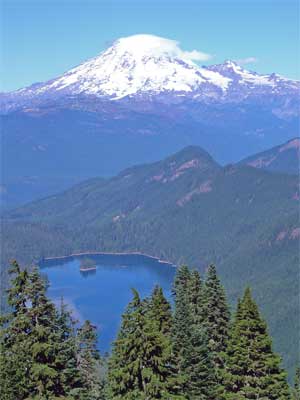
The trail is very nicely graded and climbs gradually to the ridgetop along the south slope, with peeks at Mt. Adams. It then follows the ridgetop for a way, with none of the brutal ups and downs that ridgetop trails sometimes observe. As the ridge rises, the trail slips onto the north-facing slope, changing the views to the north, with Mt. Rainier and Packwood Lake as the stars. The temperature also dropped noticeably. Parts of the ground were still frozen, but the air was warming, even on this side. At about 3.5 miles, the view opens to the west, showing the snow-dusted slopes of Johnson Peak over the ridge ahead. Soon, the trail crosses the ridge to the south side again and begins the circuit of Lily Basin, the cirque at the head of Glacier Creek, under the cliffs of Johnson Peak.
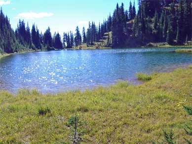
The end of the traverse brought us to the ridge of Angry Mountain and a junction with the Angry Mountain Trail 90, which traverses its namesake ridge eastward and drops down to a road at 2700’ in the valley of Johnson Creek. We headed the other way, dropping into the Middle fork of Johnson Creek and up to Heart Lake, which is nestled into the head of the valley on the south slopes of Johnson Peak. Heart Lake sits in a large meadowy basin, with lots of camping and wandering area. We spent an hour just lounging in the sun and enjoying the best kind of fall weather.
No comments:
Post a Comment