November 26, 2006

Thanks for Thanksgiving

I’ve been so taken up with work for the last couple of months that I haven’t had energy for much of anything else, but this four-day weekend was just the thing. I got some rest, let the work stuff subside for a while, hit Wagner’s twice, and visited my family in Seattle for the annual feast.

Months ago, I had decided on a new car, but was stymied by the anticipation of a repeat of the deeply annoying process of buying my last car. So, I dawdled for months, while getting more and more over my eleven-year-old Kia Sephia. This weekend was my chance – a couple of days to rest and get psyched – so on Friday I went into the local dealer and bought a new Subaru Forester. Much to my surprise, it turned out to be a pleasant experience (except for the expense, of course, but we try not to think about that). My timing couldn’t have been better, because this morning we were greeted by an inch of slippery snow.

Red Subaru Forester
The Forester passed the test: it was able to climb the driveway into the garage. No trouble at all.

November 10, 2006

Bruce Cockburn is a Treasure

My wife and I attended a great Bruce Cockburn concert at the Washington Center last Tuesday. It was a near thing – we almost missed it – and I’d have to say that it was poorly promoted. Perhaps the change from the Capital Theater, where I saw him perform to a packed house a couple of years ago, interfered. The audience that was there certainly seemed to enjoy and appreciate him. I know I did. His band of a drummer and keyboard player-and-singer were very good, as well. He played a pleasing mix of old and new songs, though many in the audience knew them all (I was behind on the new ones, though I think it’s time to pick up another CD).

For those that don’t know, Bruce is a Canadian songwriter and guitar player and singer from Canada. I’ve followed his work for decades and have seen him in concert eight or ten times, in Seattle, Olympia, and most recently, aside from this week, at the Vancouver Folk Music Festival.

He’s a superb songwriter, an amazing guitar player, and an inventive singer. He is also a person – and a musician – of uncommon integrity. He’s not much for the clever banter and never appears comfortable with the crowds, but he his very comfortable with his music.

Our host at our second agriturismo on our recent trip to Italy was a guitar player and fan of popular music. I was surprised and pleased that one of the names that he rattled off as influences was Bruce Cockburn (pronounced phonetically). He even played one of his songs for us (forgotten which, but one I knew). I see Bruce whenever I get a chance. You should consider it.

The Sights We Saw

In my first Italy post, I mentioned a lot of the places we visited and the sights we saw. In this one, I thought I’d highlight the, well, highlights of the places we visited.

No visit – certainly no first visit – to Italy would be complete without spending at least some time amongst great art and amazing antiquities. This trip was no exception, but we also saw some wonderful modern art and beautiful countryside that was at least a match.

The highlights of Rome were the powerful statue of Moses by Michelangelo, tucked away in the  San Pietro in Vincoli, quite near our hotel, actually. I remember seeing slides of this statue in my seventh grade Art Appreciation class. (That class was one of the great awakenings of my young life. I still remember portions of it vividly.) It made it on our list because my sister-in-law had insisted to my wife to not miss it. San Pietro in Vaticano was stunning, enormous, and oddly soaring and oppressive at the same time. Walking back from San Pietro, we passed by the Pantheon, which is more beautiful for its antiquity and simplicity. For a thousand years, it was the largest dome in western Europe. My biggest delight of that day of delights, though, was the Trevi Fountain. As you approach, you begin to hear the rush of the water and then, you enter the square and you’re there, with this Baroque wonder.

We spent the following few days staying in Montepulciano and touring the hill towns of Tuscano and Umbria. That topography was one of the highlights of the trip. Long, misty vistas, dramatic, cloudy skies, and charming, walled towns perched on all of the highest hilltops. The façade (and interior) of the Duomo in Orvieto was stunning. We arrived in late afternoon and the lowering sun struck the face directly, absolutely lighting up the gold and white of the decoration. Inside is another delight – one of the chapels is decorated by amazing frescos depicting the Apocalypse. Meanwhile, a small gang of kids was playing soccer against the white and black stripped side walls.

Besides the views of the city from the town of Fiesole to the northeast and the Giardino Boboli to the south, the highlights of Firenze were in the museums. The Galleria degli Uffizi was too big for the time we had allowed for it, but we saw some wonderful paintings in a beautiful building, which has been an amazing museum for centuries. But the best for me was the Botticellis, with the prize going to his The Birth of Venus, which is the most beautiful painting I’ve ever seen. Later that afternoon, we visited the Galleria dell'Accademia nearby, where the star, by far, is Michelangelo’s David. It is amazingly impressive, if only because it is so much larger than I had supposed. I must have circled it a half-a-dozen times.

The next segment took us to Liguria and we spent two days on trips to the coast. My favorite element of that were the Ligurian Sea and the dramatic rocks and cliffs of the coastline. The water was clear and blue and warm. The cliffs plunged into the sea, with only a few pockets of beach, around which the little towns were clustered and sometimes piled. That and the wonderful seafood.

Venezia itself was a highlight. For all of the antiquity that we’d seen in Italy and for all that Venezia contains, the Peggy Guggenheim Collection came as a refreshing surprise. Jumping five centuries in art can be a shocking experience (I remember skipping from the seventeen century to the nineteenth in the Louve and being struck, for a time, until my eyes adjusted, by the thought that those crazy Impressionists couldn’t paint.) but it came as a revelation to me. The collection is awesome. Nearly every early twentieth century artist I’ve heard of was represented there, including Pollack’s stunning Alchemy. There were also amazing works by Calder, Chagall, De Kooning, Duchamp, Ernst, Giacometti, Klee, Magritte, Mondrian, Moore, Motherwell, Picasso, Rothko and a bunch more I hadn’t heard of. As for buildings, the Palazzo Ducale was amazing, a huge house for and monument to the power of Venezia.

Still want to go back.

November 5, 2006

Our Lodgings in Italy

I’ll expand my previous post, in which I described the itinerary of our recent trip to Italy, by describing the places we stayed in more detail and bringing a focus onto the big discovery for me – the agriturismo. All of the places we stayed in Italy were very nice, with helpful staff, enough English to get by, and comfortable beds. They’re marked on this map with the blue tags.

In Rome, we stayed in the Hotel Nardizzi Americana on Via Firenze, between the Termini and the Spanish Steps. It’s on the fourth floor of the building (though our rooms were on the first floor, just up from the ground floor). The stairs are large and gentle, but for those with luggage or other issues with stairs, there’s a small and Spartan, but smooth and quiet elevator. The rooms were spacious and attractive and the breakfast was good. We used the Internet terminal to look up agriturismos in Liguria. The hotel is also well-situated for getting around in Rome.

Our second stay was at the Azienda Agriturismo Nobile, just outside of Montepulciano. This was our first agriturismo and it certainly impressed for the beauty of the farm and its surroundings. We arrived after dark and were greeted in our room by the full moon streaming directly in the window of our bedroom. The rooms were in a remodeled and expanded farmhouse and our rooms were an apartment, really, with three bedrooms, two baths, and a kitchenette.

The farm seemed to be that of a gentleman farmer – it was very well-groomed and prosperous-looking – and had both grapes, some of which were being harvested while we were there, and olives. This agriturismo falls into the more luxurious category, as it even had a swimming pool. It didn’t, however, include meals for guests, nor did it involve any real interaction with the people there. They had there own nice house on the other side of a big hedge and the owners spoke no useful English (and our Italian was equally useless), so we didn’t really learn anything about them.

Our beds in Firenze were in the Hotel Villa Bonelli in neighboring Fiesole. This was a very nice place in a nice little town (with a longer history, actually, than Firenze down in the valley), up on a ridge above the valley. It offered a couple of nice restaurants and marvelous views of the city below and the surrounding hills and towns. The hotel was also very comfortable and offered a nice breakfast. There was a big German tour group staying there, which was kind of interesting. We used the Internet terminal to finalize our list of agriturismos in Liguria and made the reservation from there.

Our second agriturismo was the Azienda Agriturismo Carnea, just north of La Spezia and east of the Cinque Terre. It was well out of the beaten path, but offered the best views of all, as it was perched near the top of a wild and rugged ridge, from which we could look east to the marble mountains of the Apuan Alps and south, over the ridges and La Spezia, to the Ligurian Sea. The rooms were quite small, but comfortable and more than adequate. Because the hospitality was the joy here. We took breakfast in a large, sunny room, part of the house of our hosts, Beppe and Laura Castiglione. And two of the nights, we had dinner with them in that room, too.

Laura is a terrific cook and nearly all of what we ate was grown or produced there, on the farm – fruits, vegetables, bread, yogurt, and jams and preserves. Beppe had more than enough English to facilitate wonderful conversations, so that we learned that they had left jobs in the city (Milano) to take on this farming-and-hospitality life. We were thoroughly charmed by how well-suited they were to it. The topper was when, on our last evening there, Beppe pulled out his beloved Martin guitar and played folk and popular tunes, while some of us sang along with him. Best evening of the trip.

Our last stay, in Venezia, was at the Pensione Guerrato/Guerratino. This one was on the fourth floor, too. I don’t think there was an elevator, but it was worth the huff. The staff was very nice and had excellent English. The rooms were very large and quite stylish. And, the breakfast was also very good. The best thing about this place, though, was the location: it was in Italy, in Venezia, and well-placed within Venezia (location, location, and location). Around the corner was the fish market (where I saw more than one fellow starting a cut on a whole tuna), down the street a couple of blocks is the famed Rialto bridge, and just around the corner was a terrific restaurant where we had our last dinner in Italy (but that’s another post).

November 1, 2006

Italy Was Great

I had the wonderful pleasure of spending two weeks in Italy last month with my wife and another couple, friends of ours. This was a long-awaited trip for us – it’d been postponed at least once in the past – and we are grateful that we were able to finally to make the trip.

We arrived in Rome on the evening of Oct. 3 and had a fast and interesting taxi ride (that Fiat hit 170 kph on the way) to the Hotel Nardizzi Americana on Via Firenze. We had two full days in Rome, mostly walking from site to site, taking in the Forum archeological sites, the Coliseum, the Michelangelo statue of Moses in San Pietro in Vincoli, the Pantheon, and the fantastic Trevi fountain.

We left Rome in a rental car. Between the hassle of getting the car and the difficulty of driving it through town, we didn’t hit the ring road until about 3:00 PM. From there it was smooth sailing to Montepulciano, with a stop at Orvieto along the way (where a poster informed us that Bruce Springsteen was playing with the Seeger Session Band in Perugia the next evening).

We spent three nights at the Azienda Agriturismo Nobile, just outside of Montepulciano. During the next two days, we toured Tuscany, visiting Pienza, Montalcino, Cortona, and Assisi. This is beautiful country and the hill towns are very interesting. The first day was really a quest for wine, especially the famous Brunello, but our timing was poor: most of the wineries were closed for tasting on Saturday. We finally came across Fattoria dei Barbi, which was open – its tavern was hopping with a wedding reception – so we bought a few bottles.

The next day we headed north to Firenze, with a stop-over in Siena, where I climbed the Torre Del Mangia, which gives a panoramic view of the town and its surroundings. We stayed in Hotel Villa Bonelli in Fiesole and rode the bus down into the city and back each day. In our two days there, we visited the Giardino Boboli (which brought to mind Versailles, on a smaller scale) and Giardino Bardini (which has terrific views of the city), the Galleria degli Uffizi, and the Galleria dell'Accademia. We spent our evenings in Fiesole, on the hills above the city, watching the sun set over the panorama below.

Next, we headed west, toward Liguria. Along the way, we stopped in Pisa, to take in the Field of Miracles, and in Lucca, to walk the walls around the city. We then headed up the coastal highway to tiny Carnea and our home for the next three nights, the Azienda Agriturismo Carnea. While there, in addition to the wonderful company of our hosts, we took day trips to the coast. The first day we visited the Cinque Terre. I walked the trail between Monterossa and Vernazza while my companions took the boat. We all then took the train to Manarola, from which we walked the Via Dell’Amore to Riomaggiore, where we had dinner before returning to Carnea. The next day we visited Porto Venere, where we walked through the lovely town, beautifully situated on the end of a peninsula. The Ligurian Sea is very beautiful.

We left the agriturismo and headed for Venizia, where we dropped the rental car at the lot near the train station. We took the vaporetto to the Rialto bridge stop and walked a couple of blocks to Pensione Guerrato/Guerratino. We spent the next two days seeing the sights of glorious, doomed Venezia. No cars, no motorbikes, and boats everywhere. (No flooding.) My wife and I were blown away by the Peggy Guggenheim Collection and amazed by the Palazzo Ducale. We decided pretty early in our stay there that we’d like to come back, and soon.

Italy is a great country and I loved it. The people were friendly, the land was beautiful, the cities were layered in history, the art was awesome, and the food (the food!) was the best. You can see the sites on a Quikmap here.

October 1, 2006

Temporary Expatriation

So, the executive will now be able to declare anyone in the country an enemy of the people, seize him, and lock him away for as long as it suits, without charges, and without any opportunity for any judicial review or appeal. Add to this the ability to define criminal torture now rests with that same executive and the removal of any accountability for those who might still engage in criminal torture. These are the powers of a tyranny.

I don’t have the power of rhetoric necessary to express the level of indignation required by this latest humiliation – merely one in a long string of humiliations – of the proud heritage of democracy and idealism that used to be known as America, the America I grew up believing in.

I feel beaten and empty. Yet, it is really expected. Expected that the executive would attempt to seize whatever power it could, using whatever rationale that would sell, as long as it could get away with it. Expected that Congress would, once again, cynically ignore its responsibility to defend the Constitution, the country’s position in the world, and even its constituents. Expected that the media would, once again, explain these measures in the terms that the executive uses to explain them, hiding the real scope and implications of this dramatic change in this country’s laws. And, expected that Americans would accept this as good and useful and necessary.

And so, I leave for a long-planned vacation to Italy tomorrow. I don’t know if I will feel any heat as an American in what should be a friendly country, but I wouldn’t be surprised if I do. And, I’ll deserve it – because I’m an American, I am ashamed to say.

September 27, 2006

The Big Here 04: When You Flush Where Do The Solids Go?

This continues a series of ruminations, discussion on method, and answers to Kevin Kelly’s The Big Here, a query and challenge to know the space we live in, in its shape and relationships.

4) When you flush, where do the solids go? What happens to the waste water?

I live within the sewer district of the LOTT Alliance, which, according to its Web site, provides:
wastewater management and reclaimed water production services for the urbanized area of north Thurston County, Washington. Its four government partners (Lacey, Olympia, Tumwater and Thurston County) jointly provide programs and facilities serving a 23,000 acre area and more than 85,000 people. The LOTT system currently includes a central Treatment Plant (the Budd Inlet Treatment Plant), the Budd Inlet Reclaimed Water Facility, major “interceptor” sewer lines, and three pump stations. Services include flow management, long-range planning, financing, and design and construction of capital facilities. A Reclaimed Water Satellite Plant is currently under construction.
I have always lived in an area served by sewers, rather than septic systems or some other, more primitive methods, though I recently realized that my family’s house on Whidbey Island has a septic tank. It makes it easy to ignore what happens when I flush.

All of northern Thurston County’s “wastewater” is piped to a treatment plant near downtown Olympia, where it is treated and then “discharged” into Budd Inlet. Some of that treated water, a million gallons a day at present, is further cleaned and used as reclaimed water for irrigation and other purposes.

This topic is fairly timely, even so, because of a recent rash of sewer line extension and connection activities in my neighborhood. Last summer, the utility ran a connector line 0.7 miles up the arterial that serves my neighborhood. Once the construction and the attendant traffic snarls were completed, I appreciated the slick new road surface and wider bike lane on the street, but I wondered at the time about the timing of the extension.

This summer, I got my answer, with a major development going in less than a quarter of a mile to the east, just north of 14th Ave NW. They connected the sewer line to that new connector just this week. In addition, several smaller developments have gone in to the west, also along 14th Ave. And, this week, we got a flyer (PDF) in the mail announcing the start of construction on a new pipeline to the west, along 14th Ave.

September 24, 2006

Lily Basin to Heart Lake

Yesterday, I accompanied the amazing Eric and seven other fellow Mountaineers to the Goat Rocks Wilderness on an excellent hike up the Lily Basin Trail and over Angry Mountain to Heart Lake. The weather was perfect with clear skies and warm air. And the company was excellent. Here’s a map and a slideshow.

The road to the trailhead climbs over 3000’ with one serious bump that requires either very careful driving or a high-clearance vehicle. The trailhead parking is just a pull-out on the road, though reportedly the stock trailhead, about a mile up the road, has a large lot.

The trail is very nicely graded and climbs gradually to the ridgetop along the south slope, with peeks at Mt. Adams. It then follows the ridgetop for a way, with none of the brutal ups and downs that ridgetop trails sometimes observe. As the ridge rises, the trail slips onto the north-facing slope, changing the views to the north, with Mt. Rainier and Packwood Lake as the stars. The temperature also dropped noticeably. Parts of the ground were still frozen, but the air was warming, even on this side. At about 3.5 miles, the view opens to the west, showing the snow-dusted slopes of Johnson Peak over the ridge ahead. Soon, the trail crosses the ridge to the south side again and begins the circuit of Lily Basin, the cirque at the head of Glacier Creek, under the cliffs of Johnson Peak.

The end of the traverse brought us to the ridge of Angry Mountain and a junction with the Angry Mountain Trail 90, which traverses its namesake ridge eastward and drops down to a road at 2700’ in the valley of Johnson Creek. We headed the other way, dropping into the Middle fork of Johnson Creek and up to Heart Lake, which is nestled into the head of the valley on the south slopes of Johnson Peak. Heart Lake sits in a large meadowy basin, with lots of camping and wandering area. We spent an hour just lounging in the sun and enjoying the best kind of fall weather.

Wicked

I’ve been very busy with work the last two weeks, but it’s calmed down a bit, so I have a few processor cycles to spare for writing. Thursday night was a good start putting work back into its place, because my wife and I and a set of friends traveled up to Seattle for dinner and a show.

We had a fun dinner at the Dragonfish Asian restaurant. They have an interesting menu, great food, and the company was sparkling.

The show was Wicked and played at the Paramount, one of my favorite venues in Seattle. I’ve been to many shows there, over decades, and it’s good to see it looking so good. The show was great. I knew the outlines, but I was impressed by the story – how it played off of our knowledge of the Wizard of Oz and then twisted our preconceptions, until we began to see the events that we’re so familiar with in a totally different light. I understand, however, that the happy ending we saw Thursday night differs from that in the book. It is a musical, after all, and it succeeded on that measure, too, with great performances, interesting sets and costumes, and wonderful songs.

September 17, 2006

What It’s Worth

I haven’t been able to put together a coherent blog-thought this week, because we’re installing a major portion of a major application this weekend. It’s pretty-much taken up all of my energy and it took up pretty-much all of my weekend, too. Even after an intense week (too much to do to get ready, too many other demands), which left me rather tired Friday night, I found myself excited to be going in to work on Saturday morning. Weird, huh?

But it’s because this – delivering a new application that will help people to do their jobs – is why I’m in this business.

Changes in my work over the last couple of years have left me questioning what I’m doing, so it’s very helpful to have had this weekend to remind me of what’s important. I know I won’t get any recognition from management (only this phase is on time, compared to my estimate six months ago, so I’m late, which is all that matters), but the people using the application will appreciate it. They’ve been great and it’s a pleasure to have worked with them.

Five Years On, Still Missing It

As the anniversary of what we all know this is about was approaching, I was finishing up James Green’s Death in the Haymarket, about the Haymarket “Riot”. Not to tie these two events together too closely, but there was a common element in the reaction of “better” Chicago to the agitation for workplace rights and the eight hour day in the aftermath of the Civil War, and the reaction of the larger country to the terrible events on Sept. 11, 2001.

In a word: Panic.

September 10, 2006

Olympic NP, Draft GMP Comment

I described the Olympic National Park’s Draft General Management Plan and Environmental Impact Statement (Draft GMP/EIS) in this post and my review of that plan in this post. Here are the comments that I sent to the Park Service today. Comments are due by Sept. 30. See this post for information on commenting on the draft Plan.


Thank you for the opportunity to comment on the Olympic National Park’s Draft General Management Plan. The draft Plan contains a wealth of information about the Park, a solid set of well-written analysis, and an exciting list of opportunities available to the Park Service for preserving and enhancing the Park and its value to the environment and the country’s citizens.

My interest in the Park and its plans is motivated by decades of hiking, camping, and climbing in the Olympics. It is my favorite place in the state for enjoying the outdoors and its wildlife. It truly is “unmatched in the world.”

My comments will focus on the balance selected for the Preferred Alternative D, between the cultural and natural resource protection emphasized in Alternative B and the increased visitor access emphasized in Alternative C. I believe that the balance selected shortchanges natural resource protection, misses important opportunities to enhance those protections, leans far too heavily toward visitor access and development within the Park, and does a poor job of explaining the process behind and reasons for those choices.

Boundary Expansions

Boundary Expansions were proposed in Alternative B in “five critical areas (Lake Crescent and Ozette Lake, and Hoh, Queets, and Quinault watersheds) to conform with watershed basins to help recovering salmon populations and protect critical elk habitat.”

The first missed opportunity in the Preferred Alternative D is the severe reduction in boundary expansions described in Alternative B and chosen for the Preferred Alternative. Some of the boundary expansions in Alt. D are even smaller than those described in the development-oriented Alt. C. It is hard to understand why the planners restricted the recommended boundary adjustments to such a degree – there is no discussion of the trade-offs or reasoning behind the selections for Alt. D.

The expansion proposed in Alt. B for the outlet of Lake Crescent and almost the entire watershed of its other major tributary, Boundary Creek, is reduced, in Alt. D, to a small area of the Lyre River around the outlet of the lake, removing the protection of Boundary Creek. The Ozette Lake expansion in Alt. B, which includes the major portion of the area that drains into the lake, is reduced, in Alt. D, to a narrow strip around the lake which bears no relation to the watershed boundaries. The Queets River expansion in Alt. B, which includes the all of the land north of the river to the top of the ridge, is reduced to a small, arbitrary segment well down the river. The Hoh River expansion in Alt. B, which would include much of the South Fork watershed, and the Quinault River expansion, which would add a good strip of land along the south shore of the river from Lake Quinault to the Park boundary, both simply disappear in the Preferred Alternative.

Boundary expansions can be expensive, of course, but they do not have negative impacts on visitor access, like some of the other elements in Alt. B. Maintaining the boundary expansions described in Alt. B is an excellent way to maintain a balance between resource protection and visitor access, considering the dramatic increase in development areas within the Park, as proposed in Alt. D.

River Zones

Several of the Park’s roads and facilities lie in the floodplains of salmon-bearing rivers. Alternative B suggests a “river zone” for the Quinault, Hoh, and Queets Rivers. In the words of the draft Plan, this would mean that the “range of management actions that might be undertaken to address changes in resource conditions include removing facilities or roads, closing and rehabilitating unwanted trails, closing areas seasonally, removing invasive plants and revegetating using native plants, and expanding educational programs.” This could mean allowing natural river meander changes to break roads and trails and subsequently moving roads and facilities out of the floodplain.

These kinds of measures create an opportunity for greatly improving the health of these important rivers and their lowland habitat. Obviously, moving roads and facilities could incur significant costs. And they could – I emphasize “could” – affect visitor access, at least temporarily.

Even so, the planners should reconsider adding the river zones to the Preferred Alternative, especially on the Queets and Quinault Rivers. The zones on those two rivers seem to carry higher benefit to cost ratios, considering where on the river they occur, the facilities that they might affect, and the area that they protect. This change would effect a significant and necessary change in the balance of natural resource protection and visitor access.

Development Zones

One of the alarming elements of the Preferred Alternative D is the selection of every “development zones” suggested in Alt. C. In one case, the Hoh area, Alt. D includes even more area than suggested in Alt. C. This is an example of a serious step out of balance in the draft Plan.

Now, I like the developed areas found in the Park today. I use the running water and flush toilets, the interpretive structures, and the park operational facilities, as well as, of course, the roads and trails. Still, I question the dramatic expansion in the development zone area in certain places in the Park. Two factors support this question.

The first is this quote from the draft Plan, which suggests that most facilities will continue to function well:
“Most existing facilities provide good visitor opportunities and, based on projected trends, will continue to function well…Certain frontcountry visitor centers are extremely crowded during the summer season, and the displays are outdated.”
I may have missed it, but I didn’t see a description of problems with the facilities, other than that one mention of crowding, which would be in August, according to the visitation data provided in the draft Plan.

The other factor comes from the visitation data provided in the draft Plan. Although the last fifteen years of data suggests a slow growth in visitation, up to 4 million visits over the next ten years (from just over 3 million 2004, the last year reported in the draft Plan), the last twelve years show a flat visitation trend, running at about 3.4 million annual visits. This doesn’t suggest the need for a dramatic increase in development in the Park and calls into question the need for the proposed dramatic increase in the development zone. The planners should reconsider the selection of development zones in the plan, in order to promote a better balance between development and natural resource protection.

Conclusion

The draft Plan contains excellent information about the Park, clear descriptions of opportunities for fulfilling the goals of the Park Service and the enabling legislation for the Olympic National Park, and a set of choices in the Preferred Alternative D that should be reconsidered, in an effort to create a more balanced Plan, one that expands the opportunities for natural resource protection and reduces some of the expansion of visitor capability, to bring them more into line with each other.

The boundary extensions suggested in Alternative B should be restored to the Preferred Alternative. These extensions offer the most effective means to protect watersheds and habitat available to the Park, at no cost to visitor access. The river zones, especially on the Queets and Quinault Rivers should be reconsidered for the Preferred Alternative, as an important means for repairing some of the damage done by previous settlement and park development, especially considering the increasing value placed on dwindling wild salmon runs. Finally, the dramatic extensions of the development zone in the Preferred Alternative should be reconsidered, because of the impacts these might bring to the protection of the Park’s natural resources and in light of the ambivalent nature of the information available about the demand for these developed areas.

Thank you, once again, for considering my comments on this important planning effort. I look forward to reading the final Plan and seeing it put into action over the next decades.

September 4, 2006

Olympic NP Draft GMP Review

I described the Olympic National Park’s Draft General Management Plan and Environmental Impact Statement (Draft GMP/EIS) in yesterday’s post. In this post, I’ll describe the elements of the plan that interest me for comment.

I started with the Olympic Park Associates’ (OPA) Preliminary Assessment. While their assessment of the draft Plan covers more ground than I’m able to, it is a good place to start for those interested in commenting on the plan. The scope of my comments includes the size of boundary adjustments proposed, the definition of river preservation zones in key areas, and the scale of the development area within the Park

Alternative D is a selection of elements from the two straw man alternatives: B, which emphasizes resource protection and C, which increases visitor access to the Park. Neither of those alternatives meets the requirements of the planning process and the Park’s purpose, but they are very useful for identifying opportunities for both of those topics. My assessment of alternative D is that it misses several of the key opportunities identified in alternative B. It also greatly increases the area available for development in the Park. The overall result of these choices is that the draft Plan creates a “balance” that leans heavily away from the protection and enhancement of the natural resources contained in the Park.

Boundary Adjustments

Alternative B contains a set of proposals that are exciting to me, as I’m interested in the ability of the Park to contain and preserve ecosystems. Much of the Park’s boundary is arbitrary. Some of those straight lines are adjusted by adjoining wilderness boundaries that provide protections along watershed boundaries. Alternative B represents an opportunity to fix more of these problems and without any cost to visitor access. So, why does Alternative D contain such a watered-down version of those possible adjustments?

In the words of the OPA’s assessment: “Park boundaries could be expanded in five critical areas (Lake Crescent and Ozette Lake, and Hoh, Queets, and Quinault watersheds) to conform with watershed basins to help recovering salmon populations and protect critical elk habitat.”
  • The Lake Crescent (link to PDF map, around 2.0 MB) boundary adjustment in Alternative B includes the lake’s outlet, the Lyre River, and all of its major tributary, Boundary Creek. This has been reduced to a small portion of the Lyre River around the outlet of the lake.

  • The Ozette Lake (link to PDF map, around 2.0 MB) adjustment in Alt. B includes the major portion of the area that drains into the lake is reduced to a narrow strip around the lake, which bears no relation to the watershed boundaries.

  • The Hoh River (link to PDF map, around 1.3 MB) adjustment in Alt. B includes much of the land adjacent to the Park that is in the South Fork Hoh River watershed and extends the Park’s boundaries down the main fork of the river for another mile or two. This disappears in Alt. D.

  • The Queets River (link to PDF map, around 1.5 MB) adjustment in Alt. B, which includes all of the north-side watershed of the river, is reduced to a small, square-boundary portion in Alt. D. This adjustment is sorely needed. The protected area is very narrow here – you can mostly see through it along the river.

  • The Quinault River (link to PDF map, around 2.3 MB) adjustment in Alt. B would add a good strip of land along the south shore of the river from Lake Quinault to the Park boundary. This also disappears in Alt. D.
It’s not clear why the planners dropped these solid attempts to protect intact watersheds, but in doing so, they miss a golden opportunity to improve the ecological integrity of the Park. The adjustments suggested in Alternative B should be restored to the Plan.

River Zone

Several of the Park’s roads and a few of its facilities lie in the floodplains of salmon-bearing rivers. Alternative B suggests a “river zone” for the Quinault, Hoh, and Queets Rivers. (The links above for the named rivers show the areas proposed in purple.) In the words of the draft Plan, this would mean that the “range of management actions that might be undertaken to address changes in resource conditions include removing facilities or roads, closing and rehabilitating unwanted trails, closing areas seasonally, removing invasive plants and revegetating using native plants, and expanding educational programs.” This could mean allowing natural river meander changes to break roads and trails and moving roads and facilities out of the floodplain.

These kinds of measures create an opportunity for greatly improving the health of these important rivers and their lowland habitat. Obviously, moving roads and facilities, including the Hoh Visitor Center (should that be decided upon), could accumulate significant costs. And they could – I emphasize “could” – affect visitor access, at least temporarily.

The planners should consider the creation of river zones more carefully, especially on the Queets and Quinault Rivers. The zones on those two rivers seem to carry higher benefit to cost ratios, considering where on the river they occur, the facilities that they might affect, and the area that they protect.

Development Areas

One of the alarming aspects of the development-oriented Alternative C is the enlargement of the “development zones” in the Park, many of them in river floodplains. The zone concept, according to the Plan, is “concentrated visitor service facilities, overnight lodging, developed campgrounds (with up to 250 campsites, flush toilets, and cold running water) and park operational facilities would be accommodated. Road access is via unpaved or paved road.” (Draft GMP/EIS, p. 57)

Now, I like the developed areas found in the Park today. I use the running water and flush toilets, the interpretive structures, and the park operational facilities, as well as, of course, the roads and trails. Still, I question the dramatic expansion in the development zone area in certain places in the Park. Two factors support this question. The first is this quote from the draft Plan, which suggests that most facilities will continue to function well:

“Most existing facilities provide good visitor opportunities and, based on projected trends, will continue to function well…Certain frontcountry visitor centers are extremely crowded during the summer season, and the displays are outdated.” (Draft GMP/EIS, p. 74)

I may have missed it (the draft Plan is quite long and I didn’t read every word), but I didn’t see a description of problems with the facilities and how they definitely needed expansion. The other factor is the visitation data provided in the draft Plan. Although the last fifteen years of data suggests a slow growth in visitation, up to 4 million visit over the next ten years (from just over 3 million 2004, the last year reported in the draft Plan), the last twelve years show a flat visitation trend, running at about 3.4 million over those twelve years. This doesn’t suggest the need for a dramatic increase in development in the Park.

These areas are proposed for significant development area expansion:
  • Elwha (link to PDF map, around 1.6 MB) – The area around the Elwha is expanded in all of the alternatives, except the status quo. It’s not clear what plans the Service has for those development zones, as the details provided in the maps and alternative descriptions do not specify them. I’m particularly concerned about the extension of the development areas around the Lake Mills area, which will, once the Elwha dams are removed, become extremely sensitive to the disturbances that development will bring.

  • Hoh (link to PDF map above) – Surprisingly, the area proposed for the Alt. D is even larger than the area proposed for Alt. C. No details about the planner’s plans for this additional area are specified, at least that I could find.

  • Quinault (link above), Sol Duc (link to PDF map, around 1.6 MB), Staircase (link to PDF map, around 0.8 MB) – Likewise, I can’t tell from the materials I could find the reason for the significant expansion of the development area.
In the absence of a demonstrated need for expanded facilities and the management of larger areas for developed facilities and considering the lack of information about the actual plans for those zones, I can’t support the expansion of the development zones as proposed in Alternative D. There may be good reasons for these expansions, but the draft Plan does not make those clear.

Conclusion

The draft Plan is a well-built document, full of excellent information, with good descriptions of the Park and its alternative futures, and containing solid analysis of those alternatives. Unfortunately, the preferred alternative is timid and leans too heavily in the direction of visitor access, shortchanging the goal of protection of the unique and world-class resources contained within the Park. It should include all of the boundary changes proposed in Alternative B, not the seriously diminished and unjustified options proposed in the preferred alternatives. The Plan should also include more consideration of the River Zone designations proposed in Alternative B, though there may be significant costs associated with them. Finally, the Plan should also reconsider the dramatic expansions of the Development Areas proposed in the preferred alternative. With the excellent work put into the draft Plan by the planning team and carefully considered improvements, the final Plan can be a document that will guide the Park into the future of resource protection and visitor enjoyment and recreation.

September 3, 2006

Olympic NP Draft GMP

The Olympic National Park has released, for public comment, its Draft General Management Plan and Environmental Impact Statement (Draft GMP/EIS), the first management plan draft since 1976. The comment period has been extended to Sept. 30. I’m interested in the Park’s plans as an avid hiker and seeker of wilderness, and as a citizen, in a sense an owner of this incredible resource, I have an interest in its continued protection in the future. So, yesterday, I read through much of the draft plan (although I read some sections more closely than others) and will write about it here in three segments: a description of my reading of the plan, a description of my conclusions from the reading and from some other perspectives that I’ve seen, and, finally, a draft of the comments I will make to the Park Service’s planning process.

The draft Plan is a remarkable document, over 400 pages all told, containing a wealth of information about the park – its history, landforms, ecology, and operations. The analyses of the alternatives presented, I think, were thoughtful, well written, and useful. I applaud the planners and everyone involved in the years-long effort to think about the future of the Park and to write up plans its future.

For those not familiar with Olympic National Park, it occupies “the central core of the Olympic Peninsula, along with a narrow strip along the peninsula’s Pacific Coast.” (Draft GMP/EIS. Page 4.) It is recognized as a World Heritage Site by UNESCO. In its evaluation of the Park, UNESCO states:
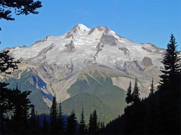
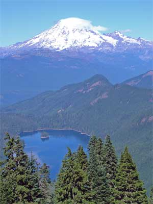
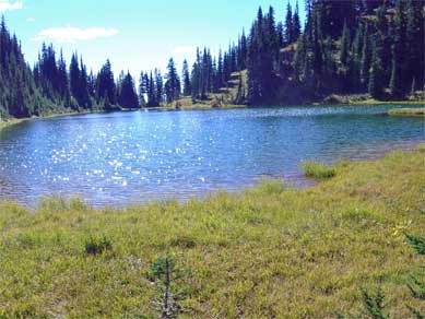
Olympic National Park is the best natural area in the entire Pacific Northwest, with a spectacular coastline, scenic lakes, majestic mountains and glaciers, and magnificent temperate rain forest; these are outstanding examples of on-going evolution and superlative natural phenomena. It is unmatched in the world.
The draft Plan notes (page 9) that the enabling legislation of Olympic National Park (Act of June 29, 1938, 35 Stat. 2247) “states that Olympic National Park is ‘set apart as a public park for the benefit and enjoyment of the people.’” And that the “House Report 2247 lists the potential benefits and enjoyments of the park. According to the House report, the purpose of Olympic National Park is to
preserve for the benefit, use, and enjoyment of the people, the finest sample of primeval forests of Sitka spruce, western hemlock, Douglas fir, and western red cedar in the entire United States; to provide suitable winter range and permanent protection for the herds of native Roosevelt elk and other wildlife indigenous to the area; to conserve and render available to the people, for recreational use, this outstanding mountainous country, containing numerous glaciers and perpetual snow fields, and a portion of the surrounding verdant forests together with a narrow strip along the beautiful Washington coast.”
The draft Plan lays out four alternatives: A, the status-quo; B, which emphasizes “natural and cultural resource protection;” C, in which “park management would emphasize visitor opportunities;” and D, the preferred alternative, which balances elements of all of the other alternatives.

This dual responsibility noted above – to protect and preserve and to allow and facilitate use and enjoyment – is a key to reading the draft Plan and to understanding its conclusions and recommendations. I entered this reading with a bias toward extending the protections for the resources in the Park and for expanding the boundaries of the Park where possible. The Alternative B, where this same bias is given its reins and some real thinking about repairing impacts and increasing the Park’s protections and boundaries are considered. The other side of that question is access by the public. As I read more about this alternative, it became clear that I wasn’t likely to give up access to the extent required for Alternative B, a full implementation of which would restrict visitor access in a number of ways, some small and some large. Alternative C, in contrast, provides for significant expansion of access and development in the Park. I didn’t so much like that one, either, as I read it. So, a balancing of these two, might I say extremes, became the lens through which I read the details of the draft Plan. Indeed, that same impulse toward balance, was what produced the planners’ preferred Alternative D.

Each of the alternatives was described and evaluated in many ways. The alternatives were described in terms of their impacts using a set of management or usage zones. These are Development, Day-use, Low-use, River, Inter-tidal reserve, Wilderness trail, Primitive wilderness, and Primeval wilderness. In addition, potential boundary changes were identified for each of the alternatives.

The alternatives were considered against a series of “impact issues” and this evaluation comprised the heart of the analysis. The issues are: Air Quality, Soundscapes, Geologic Processes, Hydrologic Systems, Intertidal Areas, Soils, Vegetation, Fish and Wildlife, Special Status Species, Wilderness Values, Cultural Resources, Visitation, Visitor Opportunities, Information, Orientation, and Interpretation, Visitor Access and Transportation, Socioeconomic Environment, and Park Operations

In addition, they were evaluated against the goals of the National Environmental Policy Act (NEPA). There was a surprise here for me, as Alternative B, the most natural resource-centered option, did not fare as well as I would have expected. A quick review of the goals assigned in the NEPA tells the story. Only the first goal of the six is really focused on the natural world, while the rest talk of balance and use. Clearly, the NEPA is a compromise (as should not be a surprise). For the record, the goals are:
A. Fulfill the responsibilities of each generation as trustee of the environment for succeeding generations.
B. Ensure safe, healthful, productive, and aesthetically and culturally pleasing surroundings for all Americans.
C. Attain the widest range of beneficial uses of the environment without degradation, risk of health or safety, or other undesirable and unintended consequences.
D. Preserve important historic, cultural and natural aspects of our national heritage and maintain, wherever possible, an environment that supports diversity and variety of individual choice.
E. Achieve a balance between population and resource use that will permit high standards of living and a wide sharing of life’s amenities.
F. Enhance the quality of renewable resources and approach the maximum attainable recycling of depletable resources.

Because the scope of the draft Plan considered a great many more topics than I could readily accommodate, I began to focus on these fewer issues: the specifics of Alternative B, C, and D, especially in how they affected the protection of natural resources and processes, providing orientation and education for visitors, and providing visitor access and recreational opportunities; and how they differed on boundary changes.

Throughout my reading of the material, I was impressed by the scope of the work, the care that went into describing and considering the alternatives, and the clarity with which they were presented. Anyone interested in the future of Olympic National Park should, at least, read the Summary document and consider commenting on the proposed alternative.

All of the documents are available on-line, including the Draft GMP/EIS and the Maps of the alternatives. Review copies are also available locally (around Olympia) at The Evergreen State College Daniel J. Evans Library; at the Timberland Regional Library branches in Aberdeen, Amanda Park, Hoodsport, and Hoquiam; and in Shelton at the William G. Reed Public Library. A full list of locations with review copies is found here.

Should you wish to submit a comment to the planning process, visit this page for the form. Or, you can send a letter (on paper!), using the comment form and address here.

September 2, 2006

The Wedding

I went to the wedding of a dear friend last weekend. The bride is a young woman whom I have known since her birth. In fact, I’d known her father since the year I graduated from high school. We’d been camp counselors for several summers and, once I dropped out of college, roommates and hiking partners. By the time we were both married and living in town here, I considered him one of my two closest friends. When my children’s mother and I separated and then divorced, he was the best friend a man could have. For a time, he called me every day. He was also a loving and nurturing father, very much focused on making a good home for his children.

Something began to happen to him when he and the mother of his children separated and then divorced. I’ve seen others go through a period of exaggerated fears, you might even say paranoia, about the people around them when they receive this sort of blow. I felt the creepy pull of fear and blame myself, while I was trying to get my balance as a suddenly-single person. Still, he embraced his anger to a frightening degree. So much so, that he began to blame his children, whom he had so sheltered and nurtured only a few months before. As hard as I worked to be the friend to him that he was for me, I eventually found myself unable to understand him and to offer him the support he needed. While his soon-to-be ex was perfectly capable of taking care of herself, his lashing out at his children deeply offended my sense of what it is to be a parent. By the time he was divorced and partnering with another woman, he had essentially divorced his children, as well.

Somehow, along the way, he developed a sort of religious explanation for his abandonment of his children, but by that time, we were no longer talking. He has since moved out of state and is raising another set of children, only rarely seeing his first. I haven’t spoken to him in years. Nor did I get the opportunity at his daughter’s wedding, because he refused to attend. To their credit, his mother, brother, and sister and her family did attend, but it only served to highlight the person who was missing. It was heartbreaking.

September 1, 2006

Little Miss Sunshine

We went to a late afternoon matinee of this movie today and thoroughly enjoyed it. Pack a marvelous mess of dysfunction into a grinding, beeping VW van and take it on a road trip, desperately seeking success in a creepy, even-more-dysfunctional children’s beauty pageant, and you’ve got a heck of a good time. It was the best comedy I’ve seen all year.

August 30, 2006

Buck Creek Pass

The weekend before last, I went on a hike with three other Mountaineers to Buck Creek Pass. It’s located in the central Cascades, just east of Glacier Peak, which looks like this: Glacier Peak, WA
It was a great backpack, with a great group.

The first day was more driving than hiking, so we started in the heat of a hot day on the hot side of the mountains. That and the late start meant that we didn’t get to the pass the first day, but found a very nice little camping spot on a small tributary of Buck Creek. There’s a much bigger camp about ten minutes past our site. Besides the heat, the key first impression of this valley is that many of the trees are suffering from some sort of disease, which results in their branch tips are dead or dying. Higher in the valley, around 5000’, this seemed to abate.

The next day, with an earlier start, we made the pass a little after noon. The trail is very good, with a very steady grade. My old Holden quadrangle (data from 1944, minor corrections in 1968) has the trail following the creek all the way to the pass, but the real (probably new) location is much better, considering the steep terrain and serious slides. Buck Creek Pass is a broad sweep of mixed tree groves and meadow, ranging between 5600 and 5800’, settled between Helmet Butte and liberty Cap. It sits on the Cascade Crest, with volcanic Glacier Peak directly across the Suiattle River valley.

That afternoon, a trio of backpackers rested in our camp’s vicinity. Carl, Gretchen, and Andrew were about half-way through a three week section hike of the Pacific Crest Trail, having started at Stevens Pass, bound for the Canadian border. This was the last section of the Trail, the end of a fourteen year project to hike the entire way. They were looking forward to the laundry at Stehekin the next evening.

Flower Dome is an easy side trip from Buck Creek Pass. It lies just east of the pass and is wrapped with lush, flowering meadows. While walking through one to get a look back at the Pass, I flushed a grouse (which startled the heck out of me, as usual). The top is almost all open meadow and has great views. A few days later a hiker asked if you could camp on Flower Dome and I realized then that you could. There’s lots of room, as long as you carry your water over from Buck Creek Pass. On the way back, I surprised a marmot munching on the meadow plants.

The third day we spent hiking the good trail south, along the crest, almost to High Pass, which offers a route into the Napeequa River drainage. This is a great route. The trail switchbacks up the north side of Liberty Cap, before sliding around the west side, where it traverses through more beautiful meadows around the Cap to a pass to its south. Another meadowy traverse around the next bump on the ridge and then passing onto the east side of the ridge, along steep, rocky slopes, to a third pass. From there, we entered the rock and snow basin between our ridge and High Pass. There’s a beautiful, greenish-blue lake in that basin, which is the source of Triad Creek. One snowfield was a little too firm and a little too steep for the group to be able to get to High Pass, so we settled (if you could call it that) for expansive views to Glacier Peak, massive Clark Mtn., the Entiat range, and assorted other peaks in every direction you could look. On the return, there was fresh smoke arising behind Mt. Fernow, Seven Fingered Jack, and Mt. Maude, just one more fire to add to those still burning in the wilderness to the northeast.

Each afternoon in the pass, we witnessed a major landslide on Glacier Peak, filling Chocolate Creek with a cloud of dust, which then traveled down the valley into the larger Suiattle valley. We returned the next day, hiking out, stopping for dinner in Sultan, and worked the I-5 traffic to home, tired, but satisfied.

August 27, 2006

Good News About the Nisqually River

I’ve been absent here for almost two weeks because of the press of events, but also because I’ve spent every available computer hour with any sort of mental energy on applying for a different job. I’ve finished that now, so we’ll see how that works out. In the meantime, I’ll catch up.

About ten days ago, I attended a session of the summer lecture series at the Nisqually National Wildlife Refuge (NWR). The series is an annual, summer event sponsored by the Nisqually NWR Friends group. The session was entitled “Recovering Salmon, Restoring the Nisqually Watershed and it was presented by Jeanette Dorner, the Nisqually Tribe’s Salmon Recovery Program Manager.” It was my favorite of the year, not the least because of the energy and passion of the presenter, but because of the good news she brought. Good news is rare in the salmon recovery, environmental restoration and protection world, at least from what I can see.

It turns out that the Nisqually River is better off than the other rivers that flow into Puget Sound. Its estuary is relatively intact (thanks to the Nisqually NWR and the effort during the 70’s to prevent the estuary from being converted to a “super port” for the shipment of logs overseas. The two dams on the river probably do not constrict the salmon bearing length of the river (a now-submerged, impassable waterfall previously served as the end of salmon habitat). There are no big cities parked along its length, as is the fate of the Puyallup and the Snohomish. Most of the land along the banks of the river is in some sort of protected status, either because it’s in the NWR or because of the type of ownership. Much of the course of the river and its tributaries is still undisturbed and useful for salmon and other wildlife. Its waters are visited by several of the species of salmon native to the area, perhaps all of them that historically used the river. And, most important, the river’s banks are home to a committed steward of the river, the Nisqually Indian Tribe.

Ms. Dorner talked about several of the restoration projects that the Tribe has undertaken in recent years and also talked about plans for more, as funding becomes available. The Mashel River is the largest tributary of the Nisqually and has been channelized through some portions of its length, which greatly reduces its value to fish, because it reduces hiding places, spawning areas, and increases flow speed. She described the construction of log jams – engineered log jams! – that help restore resting and hiding places for fish, as well as spawning habitat, by sorting gravel and creating deeper pools. The project led to a dramatic increase in fish usage and survival in the year after it was installed.

Ohop Creek is a significant tributary of the Nisqually that was straightened during the 30’s, which deepens the channel and speeds the flow of water. The Tribe and its partners have gathered over a dozen landowners into an agreement to restore the creek to its previous meandering course. This project has been in planning for some time and will begin construction next summer.

A project that anyone can see just by driving through the Nisqually delta on I-5, southbound is best. Most of the delta was diked many years ago to keep the tide out and create farm land. The 100 acres on the east side of the river, outside the NWR, is now being worked on to remove the dikes and provide a fresh water connection to the wetland between the freeway lanes. This will allow most of that land to return to a salt marsh supporting the estuary habitat. A pilot project of a few acres a few years ago was very successful, with fish following the first tide onto the new wet land and birds using it that first evening.

All in all, a very satisfying evening in a world that sometimes gives me the feeling of waking up in a hand basket, wondering where I’m going.

Cross-posted at Olyblog.

August 15, 2006

The Big Here 03: Trace the Water You Drink From Rainfall to Your Tap

This continues a series of ruminations, discussion on method, and answers to Kevin Kelly’s The Big Here, a query and challenge to know the space we live in, in its shape and relationships.

3) Trace the water you drink from rainfall to your tap.

This one’s easy, because of how well the water utility of the town I live in, Olympia, Washington, reports to its customers. Each year, the city sends out a report which describes the sources of the city’s water, the results of water quality tests, and other information. To quote from the 2006 edition (PDF):

Our drinking water comes from aquifers. An aquifer is an underground deposit of sand and gravel where groundwater is stored. Aquifers are replenished by rainfall that seeps down through the soil.

From September through May, the water I use is piped from McAllister Springs, at the eastern edge of the built-up area, all the way across Lacey to the west side of Olympia, where it runs out of my tap. The brochure is a little vague on where my water comes from during the summer, but the best guess is that the McAllister Springs water is augmented by water from the nearby Allison Springs and Kaiser wells. There are a couple of storage tanks just north of my house, which is likely how the pressure is delivered to my pipes.

August 13, 2006

Meta: Remote Blogging (Return)

I meant to revise this entry, but decided to leave it there and just complete my thoughts here. In adding the links to that earlier entry, I see that it illustrates some of the defects of “real time” posting – most of the post was spent setting up the point, too little time to develop my thoughts, and no chance for revision within the limited time available on the public equipment. So, here’s my attempt to be more thoughtful.

The first issue is the practical one of how to actually draft the entry. In Ashland, I attempted to use public Internet access, but it wasn’t as easy as I thought it would be. I know that there were more public machines a few years ago than I found last weekend. More and more, “internet café” is coming to mean “wireless.” There are obvious benefits for a business to shift from providing computers to providing wireless access (less equipment expense, lower support costs, fewer security issues, and less space required). What that’s meant for Ashland is, besides the public library (which has quite a few free, public terminals), there are three public machines that I could find. Two are in a couple of coffee shops and are available for free and the third is in a copy shop, available for a minimal fee. None of these places were open on Sunday and demand was high for them all (although I didn’t try to copy shop this time). It may be that the days of relying on public machines for anything more than a quick e-mail or blog entry during business hours are over.

A personal laptop, then, fits the new world of wireless. There are a couple of other readily-apparent advantages: it’s available for writing whenever you are and you can take notes, draft, revise, and store for when you can upload to the ‘net. It really helps with the immediacy. It also has all of the tools that you are used to. (That was one of the obstacles with the two Macs in the coffee shops. Not complaining about Macs, I’m just very much less familiar with them.) It’s unlikely that I’d ever take a laptop on a hike, but it could work on a boat trip (as long as I had good protection for it). Drawbacks? More to carry, more airport trouble, one could spend too much time on the computer and not enough observing where one is, and the expense, of course.

For this trip, a laptop would have been nice, as I didn’t actually meet my objective of blogging what we were doing or seeing. It was just too hard to get the writing done in the limited times I had on the machines. A laptop back at the room could have met the need for drafting in closer-to-real-time and also allowed for a chance to review the entry before I post.

Italy in October? I dunno…

A good entry written on the day that something happens has a freshness that the more thought-over posting a few days later doesn’t. And there’s no freshness comparison at all with the entry written a week after returning from the trip. Each has its strengths: immediacy, perspective, and mature consideration, respectively. The real problem with me, though, is that I tend to wait too long for that mature consideration and other things arise to interfere and normal life returns and then I’ve got nothing. Or, at least, nothing that seems very important, anymore. Better to have something, perhaps, even if it reads like the superficial drivel of the sunburned and novelty-sated tourist.

I dunno…

August 10, 2006

Theater in Ashland, Oregon

My wife and I made our annual journey to the small town of Ashland, in southern Oregon, for a weekend of theater, good food, and relaxation. It works every time. The pattern is to drive down (about 400 miles straight down I-5) on a Thursday, see two plays a day on Friday through Sunday, and then drive back home on Monday. Every now and then we through in a visit to friends along the way or a Rogue River float trip or something, but that’s the basic plan.

The Oregon Shakespeare Festival has been operating there in Ashland for over 70 years. Their season runs from February to October and includes eleven plays in that time. The organization has three theaters: a large indoor theater, a small, flexible, indoor theater, and an outdoor, Elizabethan-style (well, except for the comfortable seats on the floor) stage. The company is permanent and quite stable, so you can see some of the same actors from year to year, which is quite a treat. I haven’t seen a bad performance in ten years.

On Friday afternoon, we saw the history, King John, which was played on a simple, but effective stage, so our focus was on the characters, nearly all of whom were embedded in an environment of greed, ambition, deceit, and violence. It was a marvelously cynical world, in which the echoes of our own time were too apparent. (There was a line bemoaning the poor intelligence that allowed the French army to land on English soil without warning that brought a hiss of recognition from the audience. Nothing but Shakespeare's words.)

At dinner after the show, there was a discussion at the next table about who was the “moral center” of the play. I'm not sure what their idea of what that concept means, but I couldn't see any of their candidates as the “moral center.” Every character was motivated by some ambition for power or money or both. The Bastard was willing to abandon anyone or anything for gain and served as a constant voice for violence. Toward the end he even began to horrify the other, equally venal characters. The only human-seeming character (other than the pawn, Arthur), was the simpler man, Hubert, who struggled to keep his head and his heart above the fray, as others sought to use him for their purposes.

Friday evening’s play was The Merry Wives of Windsor, staged on a very tarted-up Elizabethan stage with extravagantly bizarre costumes. This company knows how to pull the comedy out of the Bard's words, no doubt about it. There was slapstick, shameless mugging, and hilarious malapropisms. Quite a romp.

Saturday’s plays were a couple of my favorites: The Importance of Being Earnest in the Angus Bowmer Theater and Cyrano De Bergerac in the Elizabethan Theater. The company puts so much into their comedies. I don’t think I’ve enjoyed comedy more anywhere else. As expected, they did a wonderful job with the Earnest.

I was a little disappointed with the Cyrano. I’ve loved the play since I read it in school and I was very much looking forward to a fine, robust performance on the Elizabethan stage. Unfortunately, the understudy was in the title role and, while we’ve seen this actor do marvelous things in other performances and he knew his lines, he wasn’t able to bring the necessary panache to the role. Neither in physical presence nor in his voice was he the dominant figure that the role requires.

On Sunday afternoon, we saw a very interesting David Edgar play, Dr. Jekyll and Mr. Hyde. As I watched it, I realized that, although I knew the outlines of the story (who doesn’t), I didn’t know how it ended. I don’t think I’ve read the original. Anyway, the play is an adaptation of the original, and the several other adaptations made along the way, and it is a psychologically complex and insightful work. The set was a marvel of complexity made simple and the actor playing the lead did a terrific job with the dual role: a shrinking, diffident, troubled Jekyll and a brutal, aggressive – trouble – Hyde.

The closing play was Two Gentlemen of Verona, in the Elizabethan Theater. The play involves the conflicts and opportunities that arise from leaving the place in which one has grown up and formed one’s values and going to another place, where those values are put to the test. In this presentation, they set “Verona” in a conservative, collective kind of community modeled something after the Amish and the like, while the other place is rich, hedonistic, and looked something like the Hamptons (not that I’ve ever been there). It was an interesting way to make the environments in which the conflicts occur clear.

This performance was interesting in another way, which was a first for us in Ashland. As we were eating dinner before the performance, I looked out the window and noticed that the street trees were swaying vigorously and wondered if that meant rain. Sure enough, within a couple of seconds, someone walked by under an umbrella. It was raining and the theater was wet when we arrived, being open to the sky. The heavy rain had quit by then, but showers still threatened, so we bought a couple of plastic ponchos, which the concessionaires were selling like, well, umbrellas. If one likes, in the event of rain, one may get a refund, as long as one asks for it early enough. I saw only one couple leave. It really didn’t rain enough to worry about, once the play began.

I’m ready to go again next year, already. There’s an interesting line-up, including Checkov’s The Cherry Orchard, On the Razzle by Tom Stoppard (a favorite of mine), August Wilson’s Gem of the Ocean, and Shakespeare’s The Tempest.

August 4, 2006

Meta: Remote Blogging

I'm writing this from the public library in Ashland, Oregon, where my wife and I have made our annual pilgrimage to the Oregon Shakespeare Festival. We'll have our usual grueling theatrical two-a-days, interspersed with good meals and other lounging-about-type activities.

I've not blogged from the road before. A lot of the trips we make are not well suited to taking the time to do this. Either that or there is no possibility at all, such as when I'm off the grid (thankfully) on a hike or on a small boat. This trip offers more chances, though the clock is ticking on my 30 minutes here in the library. (So, I'm going to focus on the text and will come back later for an update and some prettying-up. Accomplished 8/13/06.)

I find it hard to write well about a trip after it is over. You can see some evidence of this from the abortive attempt to write about our January British Virgin Islands trip. Still, there is some advantage to writing after the event, for the perspective that reflection brings. Unfortunately, the energy the trip brings wanes once I've been plunged back into the workaday routine. So, we'll see what immediacy brings.

We drove straight down I-5 for almost 400 miles without mishap yesterday. Made it on one tank of gas, too, thanks to Prius. It's warm, even hot, with temperatures in the low 90's predicted for the weekend. There's a bit of a breeze and the air is dry, so it's not oppressive. We wandered around town a little this morning, making dinner plans and talking about what we want to do over the next few days. This activity is my plan for the morning and early afternoon. Then, we'll have a matinee of King John in the New Theater.

Thirty minutes is up...

July 25, 2006

The Big Here 02: What Time is Sunset Today?

This continues a series of ruminations, discussion on method, and answers to Kevin Kelly’s The Big Here, a query and challenge to know the space we live in, in its shape and relationships.

2) What time is sunset today?

One of the pleasures of living in the north half of the Northwest is the difference in the length of the days, from season to season. Not like Alaska, of course, but they might be taking things a little too far up there. Here, at least, the sun comes up every day. Still, a lot of people have trouble with those winter days when you go to work in the dark and come home after sunset. I’ll take that because it gives us these nights in midsummer when it’s still light enough to move around at 10:00.

I tend to notice the sunrise and set times throughout the year, though for reasons that vary with the seasons. During the late fall and early spring, I notice the change because it’s a qualitatively different experience to talk to and from work in the dark, as opposed to during the daylight. I spend as much time in the woods as I can, especially, but not exclusively during the late spring, summer, and early fall, and the amount of daylight matters for what I’m able to do. Because of this, I know that the latest sunset for Olympia is around 9:10, at midsummer. I also know that the sun sets at about 7:10 at the equinox (and we have just over twelve hours of daylight – “equi” indeed).

Until I started looking at this closer in preparation for writing this, I thought I could estimate the sunset for tonight using a simple proportion between those two times, which results in 8:25. The real answer is 8:53, because the change is not linear, but a curve. In the three months between the solstice and the equinox in September, the sunset changes about two hours, with 20 minutes in first month, 40 minutes in the next, and 60 minutes during the last. So, a new method would be to use the new proportions and say that we’re a little past that first month, which gives an estimate of about 8:50. Closer.

I learned this from the data that I pulled from the U.S. Naval Observatory’s Data Services site. And I built this chart from it. (Click on the image for a full size view.)

Chart of sunrise, sunset, and dayloght hours for Olympia, Wash. in 2006, with Daylight Savings Time
So, my new method for estimating sunset, at least for summer, is to determine how many months from the spring equinox we are and assign 20 minutes for the first (one-sixth of the 120 minutes change), 40 for the second (one-third of 120), and 60 for the third (or one-half of the total). I can use the same proportions for partial months. So, August 1 is about ten days into the second month, so it gets one-sixth of the second month’s 40 minutes, or 7 minutes. Subtracting 27 minutes from 9:11 results in 8:44, which is right on.

July 20, 2006

The Big Here 01: Point North

This begins the first of series of ruminations, discussion on method, and answers to Kevin Kelly’s The Big Here, a query and challenge to know the space we live in, in its shape and relationships.

1) Point north.

I have what I like to think of as a good sense of direction. I think I came about it naturally, but I’ve learned, through some disruptions, that what we call a sense of direction doesn’t just happen. It has to be grown and refreshed.

My original sense grew as a result of the strong environmental cues in where I grew up. Seattle has a regular grid of streets, with the avenues running north-south. It also has salt water to the west and fresh water to the east and distinct mountain ranges to the east and the west. As a result, direction was well-imprinted in my mind, even when I ventured over those bodies of water and into those mountains.

My complacency with regard to direction was shaken somewhat when I moved to the Bay Area for college. The street grids on the peninsula south of San Francisco were not laid out north and south. Everything was a little off, although I could maintain my general sense of which way was north, I carried a sketchier idea of directions for those months.

The next location I spent any time in was in west central Nebraska. That required more attention to rebuild my sense of direction. There was the river, but it didn’t take to much travel to leave it behind the last hill. And, north of town, the Sandhills spread for hundreds of square miles, with nary a directional cue, except the ever-present sun. So, I began to rely more on the sun as reinforcement to my sense of what direction was what.

I finally settled in Olympia which, though it’s near Seattle, has a different set of cues. Here, the water it to the north, I-5 runs east-west (at least north of Tumwater), and the mountains you can see are to the north. Just as with the other two examples of being out of directional sense, I remember the period where, in spite of the fairly regular street grid, I had some trouble rebuilding my sense of what direction is which way.

So, in answer to the question, I rely on my internal map of my local world to find north (or the other directions). It’s quite reliable, because I regularly refresh it with observation. That same process becomes, clearly, more important and explicit when I’m in a new place. The tools most useful to me in rebuilding my sense of direction are maps and observation.

Maps help me to understand the relationships of the major features in the area and help to identify the things I should look for as I move about. Topography is especially useful. On foot, especially, it’s hard to ignore whether you’re moving up or down and that can help you to know, if you’ve been able to gather that information, which direction you’re traveling in.

Observation is critical in three ways. It’s an important means of gathering information about the space I’m occupying. It serves as a means to integrate the information I collect through the visual observation. Most important, though, is that the observation itself actually builds my internal map. I can sketch out a place in my head by looking at a map, but it doesn’t become useful until I actually see the place.

In thinking about this question and reading the recommendations for this query, I noticed the mention of the analog watch method. I found a description of it in this WikiHow entry. Since I always have a watch and can usually tell where the sun is (we learn how to do that in the cloudy Pacific Northwest), it seems like a useful tool for recalibrating the internal map.

July 18, 2006

Beach Walk - Purdy Sand Spit

On a Saturday almost a month ago, my wife and a friend and I went on a beach walk at the Purdy Sand Spit, presented by a collection of local and state water quality agencies. The weather was terrific, the tide was -2.8’ at 11:08, and the beach was teeming. There were a good fifty people of all ages in attendance.

The guide for the walk was the local celebrity Alan Rammer, who is a Conservation Education Program Specialist with the Dept. of Fish and Wildlife, and who has spent thirty years or more walking the beaches of Washington and any place else near sea level and talking with people about the life that can be found there. He’s a local celebrity because he was the model for the character of the professor in Jim Lynch’s novel set in south Puget Sound, The Highest Tide. Lynch shadowed Rammer for a year while preparing the book.

So he started with a speech, well practiced and aimed at the kids in the group in expression, but also pointed at the adults, in which he described the beach as the living room of its inhabitants. His specific advice was to put everything back where you find it and make sure that you leave the rocks you overturn or pick up as you found them, right side up. I thought it was a nice touch.

We then headed down to the beach and looked around. Mr. Rammer knew the name and history of everything that anyone brought him, including the squid egg sacks and a deep-water fish that grows up in the shallows (forgot the name). We saw moon snails – they’re big! – and their egg sacks, which look like broken toilet plungers. There were sand crabs and rock crabs and hermit crabs, geoducks and horse clams and mussels, and sand dollars in stacks.

After the walk, we headed over the bridge to the Beach House, where we were treated to a local history exhibit and a nice lunch. Since we ate the lunch, we decided to stay for the talks after lunch. Lolling on the beach on a sunny afternoon in June is pleasant enough, even with a couple of talks about septic systems and water quality. The speakers were a Kitsap County Health District employee, Leslie Banigan, and Teri King, who works for the Washington Sea Grant Program.

It turned out to be quite excellent. I’ve always lived in houses that are connected to sewers, so I thought to learn a little about the effects of septic systems on water quality, but in a somewhat disconnected way. It wasn’t long into the presentations, however, before I realized that I am a septic system owner, at the Whidbey house. Damn. (At this point, I can visualize my mother rolling her eyes at my cluelessness. I’m slow on the uptake, but I remember once I get there.) So, I listened with new interest and learned a lot. I’ll have to find out more about the system we have out there at Whidbey, since it doesn’t get much of a workout and it’s perched right over the beach.

The whole thing, for free, was a great way to spend an early summer, sunny day: a little walk, a little beachcombing, a little lunch, a little sun, and a little learning. The whole thing was put together by Pierce Conservation District and the Puget Sound Action Team.

July 12, 2006

Messy Desk Contest

In response to Blue Wren’s challenge, here’s what on my desk, right now, besides an irregular, but noticeable layer of dust:

1. An older, but serviceable HP Deskjet 895Cse which needs a new color cartridge (it doesn’t print green anymore).

2. A Mountaineers Go Guide, July 2006 issue, and a stack of printouts (lacking in green) from the ConsumerReports.org Car Buying Kit (it’s a bit of a sore subject).

3. A stack of Grand Circle Travel (Small Ship Travel 2006, Travel Favorites 2006, and Europe 2006) catalogs my parents gave us. On top of that, a sheet of notes about airfare to Italy, which we’re visiting in October. That’s capped by my oldest nephew’s graduation announcement.

4. A small, wooden, decorated box with a very intricate inlaid top that my parents brought us from their last trip (on Grand Circle Travel) to the Middle East.

5. This computer’s monitor and speakers, which are usually turned off.

6. A plastic puzzle, which supposedly can be manipulated into a Rubic shape from its current misshapen, pointy blob of smaller cubes strung together with elastic. I’m beginning to think that I’ll never solve it.

7. A couple of note pads. Three Mountaineers release forms that I’m really supposed to send in. Three pens and a mechanical pencil. A white rock and a piece of green glass that I picked up off an Olympic National Park beach in the first weekend in July.

8. A stack of books, from the bottom:
Photoshop Elements 3, the Missing Manual edition (O’Reilly)
Mediterranean Europe on a Shoestring (Lonely Planet)
Venice (Lonely Planet)
Tuscany and Umbria (Frommer’s)
Pocket Rome (Fodor’s)
Rick Steve’s Italy 2006
Olympic Mountains Trail Guide (Mountaineers)
Backpacking Washington (Wilderness Press)
100 Hikes in Washington’s South Cascades and Olympics (Mountaineers)
Baedeker Rome (Macmillan Travel)

9. A Non Sequitur leaf-a-day calendar, with today’s offering titled “Birth of the Atkins-Shmatkins Rebellion.” Sometimes I don’t get Non Sequitur.

10. And, in the corner, a four-bin stacking file, which isn’t as full as it usually is. My stack, which is on top and often over-flows the top and will even, on occasion, spontaneously slide off into the paper recycling collection below it, is less than half full, though some of the items have been there a long time. On the bottom: a pamphlet from the Olympia Community Yoga Center titled Yoga Basics and a pretty goofy 8 x 10 of me in my friend’s boat. The next bin is my wife’s. It’s more full that mine, but less full than it usually is. I’ll leave its contents to her consideration. The bottom two are quite sparse – they were for my kids, but they’ve pretty much stopped getting mail here.

11. The odds and ends: a plastic coaster, an Oregon Shakespeare Festival bookmark, an extra mouse pad, and a small note with a list of things to remember to take to the beach house.